
Informative geography facts about our wonderful planet, detailed and easy-to-read maps, and various topics about each country! I am pleased to update my blog as a passion project and do not generate content with AI.

Showing posts sorted by relevance for query %s. Sort by date Show all posts
Showing posts sorted by relevance for query %s. Sort by date Show all posts
Monday, June 4, 2012
Former Names of Capitals
Quite a few capitals previously had different names. The following is a list of many, definitely not all, of the capitals that had different names in the past — they are categorized by continent.
AFRICA
Bujumbura, BURUNDI's former capital (Gitega is the new capital since 2019), was called Usumbura until 1962.
N'Djamena, CHAD's capital, was called Fort Lamy until 1973.
Kinshasa, DEMOCRATIC REPUBLIC OF THE CONGO's capital, was called Léopoldville until 1966.
Banjul, the capital of GAMBIA, was named Bathurst until 1973.
Antananarivo, MADAGASCAR's capital, was named Tananarive until 1975.
Maputo, MOZAMBIQUE's capital, was named Lourenço Marques until Mozambique's independence in 1976.
Harare, ZIMBABWE's capital, was named Salisbury until 1982.
ASIA
Tbilisi, GEORGIA's capital, was known as Tpilisi (Georgian) or Tiflis (Russian) until 1936.
Jakarta, INDONESIA's highly-populated capital, was known as Sunda Kelapa, then Jayakata, then Batavia, then Djakarta from 1949 to 1972.
Tokyo, JAPAN's capital located on the island of Honshu, was previously named Edo until 1868.
Astana, KAZAKHSTAN's capital, was known as Tselinograd, then Aqmola.
Bishkek, KYRGYZSTAN's capital, was named Pishpek until 1926 and Frunze until 1991, the fall of the Soviet Union.
Ulaanbaatar, MONGOLIA's capital, was known as Ugra until 1924.
Dushanbe, TAJIKISTAN's capital, was called Dyushambe until 1929 and received the name Stalinagrad until 1961.
Ankara, TURKEY's capital, was called Angora until 1930.
Ashgabat, TURKMENISTAN's capital, was called Poltoratsk from 1919 until 1927.
EUROPE
Belgrade, SERBIA's capital, was known as Singidunum in ancient times.
Podgorica, MONTENEGRO's capital, was known as Birziminium before the 11th century, Ribnica during the Middle Ages, and Titograd from 1946 to 1992. The capital possessed the name Podgorica in 1326 until 1946, resuming in 1992.
SOUTH AMERICA
Sucre, one of two capitals of BOLIVIA and named in honor of Antonio José de Sucre, was called Chuquisaca until 1825.
Credit goes to the New Oxford American Dictionary, 2nd Edition, which conveniently listed former capital names.
Thursday, January 21, 2016
Youth Literacy in Southern Africa
The countries of Southern Africa generally experience a positive increase in their literacy rates among teenagers and young adults who are 15 to 24 years old. This category is described as "youth literacy" in this post. More work can of course be done to improve literacy in these countries. Optimistically however, more and more young people can read and write than ever before. Several countries boast amazingly high literacy rates, breaking down misconceptions about the literacy of southern African residents. The following information comes from the UNESCO Institute for Statistics, and UNESCO stands for the United Nations Educational, Scientific, and Cultural Organization.
● The average youth literacy rate (2015) of ANGOLA is 72.93%.
● BOTSWANA's youth literacy rate is 97.85%. EXCELLENT!
● LESOTHO's youth literacy rate is 85.09%. Not bad, Lesotho!
● MADAGASCAR's youth literacy rate is 65.07%.
● MALAWI's youth literacy rate is 75.06%.
● MAURITIUS' youth literacy rate is 98.72%. AWESOME!
● MOZAMBIQUE's youth literacy rate is 76.67%.
● NAMIBIA's youth literacy rate is 89.91%. Nice!
● SOUTH AFRICA's youth literacy rate is 99.02%. Good job, South Africans!
● SWAZILAND's youth literacy rate is 94.77%. Amazing!
● ZAMBIA's youth literacy rate is 65.76%.
● ZIMBABWE's youth literacy rate is 91.73%. Very good!
Monday, November 25, 2013
S Countries
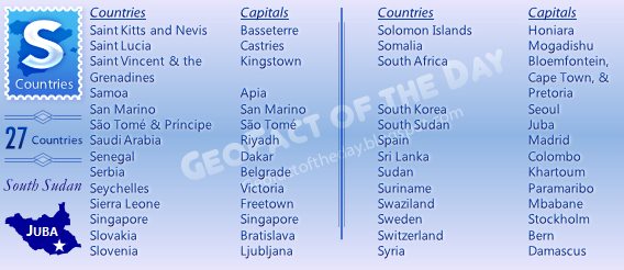 The A to Z categories are based on the English language and inadvertently might not include all native country names.
There are many 'S' countries in the world, from Saint Kitts and Nevis in North America to Syria in the Middle East. The newest country in the world is an S country: South Sudan, which is found in North Africa. S countries are found in all areas of the world: on the continents of Africa, Asia, Europe, North America, and South America, and in the Pacific Ocean (Samoa and the Solomon Islands).
Africa: Sao Tome and Principe, Senegal, Seychelles, Sierra Leone, Somalia, South Africa, South Sudan, Sudan, and Swaziland
Asia: Saudi Arabia, Singapore, South Korea, Sri Lanka, and Syria
Europe: San Marino, Serbia, Slovakia, Slovenia, Spain, Sweden, and Switzerland
North America: Saint Kitts and Nevis, Saint Lucia, and Saint Vincent and the Grenadines
Oceania: Samoa and Solomon Islands
South America: Suriname
Go to the Countries page — below the blog's header image — to find individual posts about these countries.
Thursday, November 7, 2013
Danube River
The important Danube River stretches for almost 2,000 miles in Central and Southeast Europe. It begins its journey in Southern GERMANY and then flows eastward, passing by German cities like Ingolstad, Regensburg, and Straubing. The Danube then crosses AUSTRIA, passing by cities like Linz and Vienna (Austria's capital). Next, it forms part of SLOVAKIA's southern border and HUNGARY's northern border, passing cities like Győr, Komárom, and Esztergom in Hungary and Slovakia's capital, Bratislava. The river takes a 90 degree turn towards Budapest (Hungary's capital) and heads straight down through Hungary until meeting up with SERBIA's northwest border. It then travels east through the northern part of Serbia, running by cities like Backa Palanka, Novi Sad, and Belgrade (Serbia's capital). The Danube then forms most of ROMANIA's southern border and BULGARIA's northern border. Finally, it crosses the eastern part of Romania and ends at the Black Sea delta.
0
- Post Comment Here
 Tags »
Austria,
Bulgaria,
GeoFact of the Day,
Germany,
Hungary,
Romania,
Serbia,
Slovakia,
Water
Tags »
Austria,
Bulgaria,
GeoFact of the Day,
Germany,
Hungary,
Romania,
Serbia,
Slovakia,
Water
Tags »
Austria,
Bulgaria,
GeoFact of the Day,
Germany,
Hungary,
Romania,
Serbia,
Slovakia,
Water
Saturday, January 21, 2012
Lowest Points in the World
Lake Assal and the Assal Depression, located west of the Gulf of Tadjoura in central DJIBOUTI (a small country in the Horn of Africa), is the lowest point on the African continent, boasting an elevation of -512 feet! The lowest point on land in the world (excluding deep oceanic trenches) is ISRAEL's Dead Sea, which is more than a whopping 1,300 feet below sea level; it is so salty that swimmers can easily float with minimal effort! The Dead Sea's depth pales in comparison to the Marianas Trench, the deepest trench in the world at almost -36,000 feet and almost -11,000 meters! Therefore, the Marianas Trench's depth is larger than Mt. Everest's height. Other depressions and negative-elevation points in the world include CHINA's Turfan Depression, EGYPT's Qattara Depression, and KAZAKHSTAN's Karagiye Depression.
>>> To discover more about Djibouti, visit my Djibouti post! Also, click on the 'Countries' tab above to find links to my posts of other African countries.
Friday, February 26, 2016
Flags of S Countries
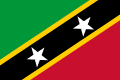
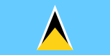
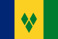
As the GeoFact of the Day Blog's S Countries post reveals, there are 27 countries with names starting with the letter S. All flag images below come from Flagpedia.net.
SAINT KITTS and NEVIS
SAINT LUCIA
SAINT VINCENT and the GRENADINES
SAMOA
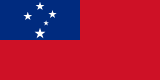
SAN MARINO
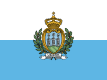
SÃO TOMÉ and PRÍNCIPE
(ST. THOMAS and PRINCE)
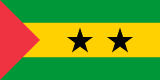
SAUDI ARABIA
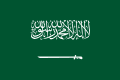
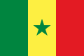
SENEGAL
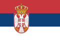
SERBIA
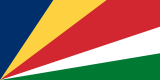
SEYCHELLES
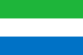
SIERRA LEONE
SINGAPORE
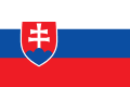
SLOVAKIA
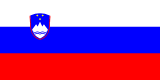
SLOVENIA
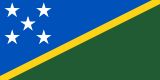
SOLOMON ISLANDS
SOMALIA
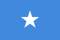
SOUTH AFRICA
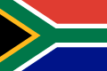
SOUTH KOREA
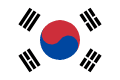
SOUTH SUDAN
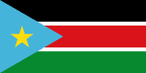
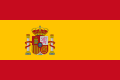
SPAIN
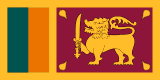
SRI LANKA
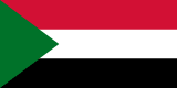
SUDAN
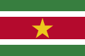
SURINAME
SWAZILAND
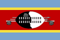
SWEDEN
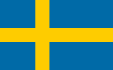
SWITZERLAND

SYRIA
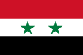
SAINT LUCIA
SAINT VINCENT and the GRENADINES
SAMOA
SAN MARINO
SÃO TOMÉ and PRÍNCIPE
(ST. THOMAS and PRINCE)
SAUDI ARABIA
SENEGAL
SERBIA
SEYCHELLES
SIERRA LEONE
SINGAPORE
SLOVAKIA
SLOVENIA
SOLOMON ISLANDS
SOMALIA
SOUTH AFRICA
SOUTH KOREA
SOUTH SUDAN
SPAIN
SRI LANKA
SUDAN
SURINAME
SWAZILAND
SWEDEN
SWITZERLAND
SYRIA
Monday, April 4, 2016
Flags of X Cities
There are no countries or territories having names beginning with the letter X, so my "X post" will feature flags of some "X cities." All flag images originate either from Flags of the World (FOTW on images) or Wikipedia (Wiki on images).
— BRAZIL —
Village in Tocantins State (north-central Brazil)

XANXERÊ
City in Santa Catarina State (S Brazil)

XAPURI
Town in Acre State (W Brazil)

XAVANTINA
Town in Santa Catarina State

XAXIM
Town in Santa Catarina State

— GREECE —
City in Thrace Region (NE Greece)

— MALTA —
Village on Gozo (Għawdex) island

XEWKIJA
Village on Gozo island

XGĦAJRA
Village on Malta island

— MOZAMBIQUE —
City in Gaza Province (S Mozambique)

— SPAIN —
City in Valencia Province (E Spain)

XERTA
Town in Tarragona Province (NE Spain)

— TAIWAN (Republic of China) —
Provincial city in northern Taiwan

Sunday, July 27, 2014
Severe Weather Alerts in the Midwest, Appalachia
Many places in the Midwestern and Appalachian United States are currently experiencing sunny conditions, but the weather might drastically change for some of those areas.
*** July 27th, 3:35 P.M. Eastern Time Update
For Tennessee's Campbell and Scott Counties, there is a TORNADO WARNING until 4:00 P.M. and one for Kentucky's Whitley County until 4:15 P.M. The Tornado Warnings in Bay County, MI and Logan County, OH expired.
*** July 27th, 3:20 P.M. Eastern Time
Bay County, Michigan, Champaign, Logan, Madison, and Union Counties in Ohio, and Clay, Jackson, Leslie, McCreary, Perry, and Wayne Counties in Kentucky all have TORNADO WARNINGS.
TORNADO WATCH for eight counties in southeast Indiana (Dearborn, Fayette, Franklin, Ohio, Ripley, Switzerland, Union, and Wayne Counties), Garrett County in Maryland, the whole state of Ohio, western Pennsylvania, and central, northern, and western counties in West Virginia.
There are Severe Thunderstorm Watches and Warnings throughout northern Indiana, most of Michigan, and northwest Ohio.
Visit the National Weather Service's website at weather.gov for the latest information.
*** July 27th, 3:35 P.M. Eastern Time Update
For Tennessee's Campbell and Scott Counties, there is a TORNADO WARNING until 4:00 P.M. and one for Kentucky's Whitley County until 4:15 P.M. The Tornado Warnings in Bay County, MI and Logan County, OH expired.
*** July 27th, 3:20 P.M. Eastern Time
TORNADO WATCH for eight counties in southeast Indiana (Dearborn, Fayette, Franklin, Ohio, Ripley, Switzerland, Union, and Wayne Counties), Garrett County in Maryland, the whole state of Ohio, western Pennsylvania, and central, northern, and western counties in West Virginia.
There are Severe Thunderstorm Watches and Warnings throughout northern Indiana, most of Michigan, and northwest Ohio.
Visit the National Weather Service's website at weather.gov for the latest information.
Friday, July 19, 2013
K Countries
Eight countries in the world have names starting with the letter K in the English language. The most "K" countries are in Asia; there are five of them. There is also one "K" country in Africa, Europe, and Oceania (a region of islands and island countries in the Pacific Ocean).

The A to Z categories are based on the English language and inadvertently might not include all native country names.
Country in Africa: KENYA is an East African country south of Ethiopia, west of the Indian Ocean, southwest of Somalia, southeast of South Sudan, north of Tanzania, and east of Uganda; its capital is Nairobi.
Country in Europe: KOSOVO is a new country located in Eastern Europe that achieved independence in 2008, although not all countries recognize its independence. The capital is Pristina (with accent on the 's': Priština).
Countries in Asia (5): KAZAKHSTAN, a former-Soviet country located in Central Asia (capital: Nursultan, previously known as Astana); N. KOREA, a Communist country on the Korean Peninsula in East Asia (capital: Pyongyang); S. KOREA, a highly-developed country also on the Korean Peninsula (capital: Seoul); KUWAIT, a small petroleum-producing country in the Middle East (capital: Kuwait City); and KYRGYZSTAN, a former-Soviet country located among the Tien Shan mountains in Central Asia (capital: Bishkek).
Country in Oceania: KIRIBATI is a collection of islands located in the South Pacific Ocean and can be found south of Hawaii; Kiribati's capital is Tarawa.
GeoFact of the Day Blog Post Links
Africa: Kenya
Asia: Kazakhstan — North Korea — South Korea — Kuwait — Kyrgyzstan
Europe: Kosovo
Oceania: Kiribati
Wednesday, April 15, 2015
7 United States Geography Facts
1) Distributed across 44 states in the UNITED STATES, Carolina Horsenettle is a thorny plant of the Solanaceae (nightshade) family. Some local and state governments consider this species a nuisance because of its propensity to spread rapidly.
2) California's mid-1800s gold rush is a rather well-known event in which many settlers flocked to California after gold was first discovered, while Alaska's first discovery of gold in 1880 is not quite as well-known. Alaska's gold was first discovered in 1800 in Silver Bow Basin valley, more specifically the town of Juneau (Alaska's capital).
3) Indisputably the world's most famous crayon brand, Crayola operates a visitor center and its main manufacturing facility in Easton, Pennsylvania. Easton is about 50 miles north of Philadelphia in Northampton County, west of New Jersey.
4) Natural Bridge State Resort Park, in the eastern Kentucky counties of Powell and Wolfe, features multiple picturesque sandstone bridge formations. This park is located in Daniel Boone National Forest.
5) On Kaua'i island in Hawaii, Waimea Canyon features marvelous waterfalls and rugged cliffs. It boasts a grand nickname: Grand Canyon of the Pacific.
6) Utah has five American national parks, all of them located in southern Utah. They are Arches National Park, Bryce Canyon National Park, Capitol Reef National Park, Canyonlands National Park, and Zion National Park.
7) As a teenager in 1811, John Hardeman Walker acquired practically the whole Boot Heel panhandle area in southeast Missouri after an intense earthquake compelled Missourians to evacuate and leave their land.
Saturday, October 27, 2012
Foreign Words for Lake
In looking at maps or in an atlas, there is almost always a different term for the English word 'lake' in practically every country. I will list, in alphabetical order, some of the terms for the English word 'lake' found throughout the world; there are undoubtedly many more.
In the Arabic language, there are at least two words for lake: birkat and buhayrat. A dry lake in Arabic is known as sebjet.
In the Tibetan language, co is the short-and-sweet word for lake, daryācheh is the Persian word, göl is the Turkish word, and hāyk' is the Amharic (of Ethiopia) word.
Järvi is the Finnish word, jezero is the word in Czech and Slovak languages (udolní is the word for 'reservoir' in Czech), jezioro is the Polish word, and khuan is the Thai word.
Lac(s) is used in the French language, lago(s) is used in Italian, Spanish, and Portuguese languages (lagoa is also found in Portuguese), loch/lough is used in the Gaelic language (of Scotland), meer is used in the Afrikaans, Dutch, and German languages, and ozero is the Russian word.
Sāgar is the Hindi word, see is another German word for lake (while strausee is the word for 'reservoir'), sjö/sjön is the Swedish word, and sø is the Danish word.
Tó is the Maygar word for lake, vatn is the Norwegian word, and vodoskhovyshche is the extremely long Ukrainian word.
Last but not least, yam is the Hebrew word for lake and sea, and zee is another Dutch word for lake and sea. If you simply find several lakes in a country on a map (or preferably in real life, of course!), you can soon find out what the word for 'lake' is in that country's main language!
>>> Know of any others? Please post a comment below; I would greatly appreciate it!
Sunday, January 24, 2016
Mousa Ali Volcano
Serving as the highest point in the East African country DJIBOUTI, Mousa Ali (Mousâ'alli) is a stratovolcano standing 2,021 meters and 6,131 feet tall. It is specifically located along a three-nation border point, connecting Djibouti's northern border with ETHIOPIA's northeastern border and ERITREA's southeastern border. Mousa Ali is fortunately dormant and has not erupted for thousands of years. Even better, the volcano is in a low-populated area away from major settlements. Communities located multiple kilometers and miles away from the relatively safe volcano include Dorra in Djibouti, Vann (over 20 miles away) in Eritrea, and Bure and Manda in Ethiopia.
Saturday, January 9, 2010
China
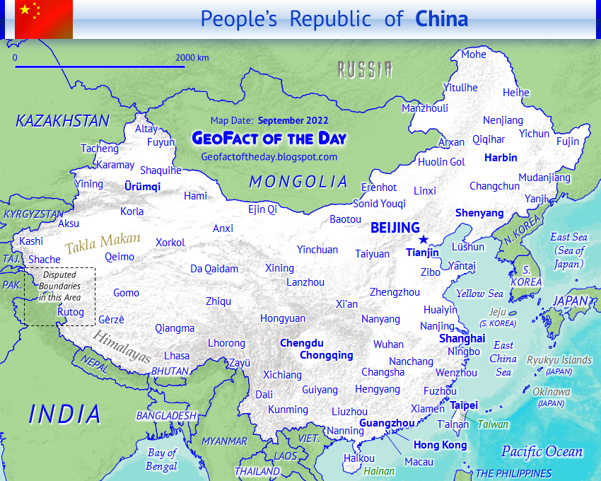
Right-click to open image in a new tab to view the map in its full size.
Officially named the People’s Republic of China (PR China, 中华人民共和国) and also known as ZHŌNGGUÓ, CHINA is a Communist country in Eastern Asia and has the largest population of any country in the world: approximately 1.4 billion (2017). The Chinese nation boasts a comprehensive, longstanding history involving the tenets of education, intense leadership, and innovation/inventions. Partially confirmed by historic records, Xia (Hsia) is the first dynasty ruling over ancient China — in existence from the years 2,100 to 1,600 BCE/BC. View the Timeline of Chinese History and Dynasty (↗) by Columbia University for a concise overview of China’s past. A total of 14 countries border China: Afghanistan (small border), Bhutan, India, Kazakhstan, Kyrgyzstan, Laos, Mongolia, Myanmar (Burma), Nepal, North Korea, Pakistan, Russia, Tajikistan, and Vietnam. From north to south, the Yellow Sea, East China Sea, and South China Sea (a.k.a. South Sea or Nan Hai) are water bodies situated east and south of China. China’s currency is the Chinese Renminbi, and the ISO 4217 currency code is CNY. In the Renminbi currency, one yuan equals 10 jiao and 100 fen. PRC China’s founding officially began on September 21st, 1949, and citizens annually celebrate National Day on October 1st.
Chinese Calendar year: 4721
4721 is the Huángdì year for most of 2024 to early 2025
4721 is the Huángdì year for most of 2024 to early 2025
● ● ● ● ● People and Places ● ● ● ● ● Boasting a metropolitan population greater than 21 million, Beijing is China’s capital but surprisingly not the country’s largest city. That designation belongs to Shanghai, which has about 3 million more residents than Beijing in its metropolitan area. Other major cities throughout China include Changsha, Chengdu, Chongqing, Foshan, Fuzhou, Guangzhou, Guilin, Hangzhou, Harbin, Jinan, Kunming, Nanjing, Nanning, Ningbo, Qingdao, Shenyang, Shenzhen, Shijiazhuang, Suzhou, Ürümqi, Wuhan, Xi’an, Xiamen, Yantai, Zhengzhou, and Zhongshan. Attractions, landmarks, and sites of interest in China — with city location(s) listed in parentheses — include but are certainly not limited to the Bund International Architecture Exhibition (Shanghai), City of Dreams (Macau), Great Wall of China (Datong, Huairou, Lanzhou, Yinchuan, etc.), Historic Center of Macau, Jingshan Park (Beijing), Jiuzhaigou Nature Reserve (Jiuzhaigou), Jokhang Temple (Lhasa), Longmen Grottoes (Luoyang), Mogao Caves (Dunhuang), Potala Palace (Lhasa in Tibet), Shanghai Circus World (Shanghai), skyscrapers of Beijing and Hong Kong (among other modern cities), Summer Palace (Beijing), Temple of Heaven (Beijing), Ten Thousand Buddhas Monastery (Hong Kong), terracotta warriors of the First Qin Emperor Mausoleum (Xi’an), Tiananmen Square (Beijing), Wuzhen Water Town (Tongxiang), and Xinjiang Regional Museum (Ürümqi).
Coastal provinces and other administrative regions from north to south are Liaoning, Hebei, Tianjin (municipality), Shandong, Jiangsu, Shanghai (municipality), Zhejiang, Fujian, Guangdong, Guangxi Zhuang Autonomous Region, and Hainan. China possesses two special administrative provinces (SARs): HONG KONG (↗) and MACAU (↗), both located in the South China Sea’s Pearl River Delta (Zhu Jiang Sanjiaozhou). Five autonomous regions with local governments sit within PR China. From smallest to largest, they are Ningxia, Guangxi, Nei Mongol (Inner Mongolia), Tibet (Xizang), and Xinjiang. Also known as the Republic of China (ROC), TAIWAN (↗) is a self-governing entity but has not achieved full independence from the mainland. About twenty countries recognize Taiwan as an independent state and maintain diplomatic relations with its government. Some countries are opposed to Taiwan’s sovereignty in fear of consequences brought on by PR China. For example, the One-China Policy states that the PR China’s diplomatic relations with countries recognizing Taiwan’s sovereignty could be halted.
The official language of national identity for China, Mandarin (Standard) Chinese is the world’s most used language for communication. As of 2017, over 1.1 billion people — that number could very well be higher — speak and write with Mandarin Chinese. Cantonese (Yue) is either considered a Mandarin dialect or an official language in Hong Kong and Macau. Another official language of Hong Kong is English; Portuguese is official in Macau. Other majorly communicated languages — and namesake ethnic groups pertaining to some languages — include Akha, Bai, Bouyei, Bunu (Bu-Nao), Gan Chinese, Hakka Chinese, Huizhou Chinese, Jinyu Chinese, Min Bei Chinese, Min Dong Chinese, Min Nan Chinese, Min Zhong Chinese, Pu-Xian Chinese, Wu Chinese, Xiang Chinese, Dong (Northern and Southern), Dongxiang, Hani, Hmong, Iu Mien, Kaduo, Kazakh, Kim Mun, Korean, Kyrgyz, Lahu, Central Lalo, Lingao, Lisu, Lolopo, Lü, Miao, Mongolian, Nasu (Wumeng and Wusa), Naxi, Nisu (especially Northern and Southern), Nuosu, Parauk Wa, Russian, Sinicized Miao, Sui, Tai Nüa, Tibetan (Amdo, Central, and Khams), Uyghur (Uighur), Waxianghua, Wuding-Luquan Yi, and various forms of Zhuang. About half of the Chinese population adheres to the tenets of religions. The relatively high rates of atheism is a vestige of religious bans during Mao Zedong’s dictatorial rule. Prominent religions worshiped today in China include Chinese Universism (almost 30% of China’s population), Buddhism (8.5%), Christianity (8.5%), ethnic religions (4.4%), and Islam (1.5%) — followed by Bahá’í Faith, Confucianism, Daoism (Taoism), Hinduism, Judaism, Sikhism, Spiritism, and Zoroastrianism.
● ● ● ● ● Land and Water Features ● ● ● ● ● The Tien Shan mountains, Taklimakan Desert, Kunlun mountains, Tibetan Plateau, and the Himalaya mountains dominate Western China, from north to south. The Gobi Desert stretches vertically across northern China and southern Mongolia. Northeast China features the Greater Khingan volcanic mountain range and the Manchurian Plain. Hainan is the People’s Republic of China (PRC)’s largest island. If the Republic of China was included in island-related statistics, then Taiwan would be the largest island of China. Taiwan encompasses an area of 35,980 km² and 13,892 mi² versus Hainan’s 33,210 km² and 12,822 mi².
Major lakes are mostly located in mountainous and glacial regions in southern China (especially in Tibet) but also interspersed among rivers in eastern China, near cities such as Nanjing, Suzhou, and Wuhan. The largest lake in China, Qinghai is situated south of the Gobi Desert in north-central China (Qinghai Province). Other large lakes include Aqqikkol, Ayakkum, Chao, Dagzê, Fuxian, Har, Hulun, Nam, Poyang, Shaobo, Siling, Tai, and Ulansu. China’s longest river, the Yangtze (Cháng Jiāng), originates from a glacier on the Tibetan Plateau and flows eastward past cities such as Lijiang, Chongqing, Yichiang, Yueyang, Wuhan, Huangshi, Wuhu, Ma’anshan, Nanjing, Zhenjiang, Nantong, and Shanghai. Other rivers include Amur (Heilong Jiang), Huang He (Yellow), Mekong, Pearl River system (Bei, Dong, and Xi rivers), Salween, and Yarlung Zangbo (connected to Brahmaputra).
The China post was updated with more information on May 25th, 2017.

Wednesday, July 25, 2012
Eastern Coast of Australia
Along AUSTRALIA's eastern coast lies the Great Dividing Range, an extensive mountain range that stretches from Cape York Peninsula in the north all the way down to the state of VICTORIA. Most of Australia's major cities, including Brisbane, Sydney, and Canberra (Australia's capital), are situated off the eastern coast; the Great Barrier Reef, the world's largest habitat for coral reefs, lies immediately northeast of Australia. Finally, the highest mountain — Mount Kosciuszko (7,310 ft and 2,228 m) — towers east of Victoria and south of Canberra.
Friday, January 22, 2016
René-Levasseur Island
View Larger Map | View Bird's Eye
Situated in eastern CANADA in Quebec (Québec) province's Côte-Nord region, Île René-Levasseur is Lake Manicouagan's circular island, featuring an area of 2,020 square kilometers and 780 square miles. The island was not always an island, being simply part of the surrounding land and crater until Lake Manicouagan was formed. See the Lake Manicouagan post below — or access it directly with the link below — for details on how this artificial, man-made reservoir was created. René-Levasseur is actually the world's second-largest island in a lake and the world's largest "artificial" island! Forests mostly cover the almost-uninhabited island with pleasant vegetation and protection from the elements, except in areas of clearcutting. Dozens of tiny lakes stud René-Levasseur, including Lac Koch, Lac Loubias, Lac Observation, and Lac Otis.
Link to Lake Manicouagan post (↗)
Thursday, February 27, 2025
A to Z Cities: Cameroon
● ● ● ● ● GeoFact of the Day . . . Facts for You! ● ● ● ● ● Highlighted and labeled on the map below, CAMEROON’s major cities include Bafoussam, Bamenda, Bertoua, Douala, Ebolowa, Edéa, Garoua, Kousséri, Kumba, Loum, Maroua, Meiganga, Mokolo, Ngaoundéré, Nkongsamba, Yagoua, and Yaoundé (national capital). While major cities are labeled on the major cities map, smaller communities with population data are displayed on this map with light orange dots. Some of Cameroon's towns, cities, and villages are alphabetized in an A to Z list below!

A — Akonolinga, Abong Mbang, Akom, Akom II, Akono, Akwaya, Alat Makay, Ambam, Amvon, and Ayos
B — Bafang, Bafia, Bafoussam, Bali, Bamenda, Bamusso, Bangangté, Banyo, Batouri, Bélabo, Bengbis, Bertoua, Bipindi, Bogo, Bokito, Botmakak, and Buéa
C — Campo, Cedea, Cha, Choua, and Cotto
D — Dimako, Dir, Dizangue, Djohong, Djoum, Douala, Doumé, and Dschang
E — Ebolowa, Edéa, Ekundukundu, Elogbatindi, Emini, Eschou, Essé, Evodoula, and Ezézang
F — Fifinda, Figuil, Folmurki, Fontem, Fotokol, Foumban, Foumbot, and Fundong
G — Galim, Garoua, Gongotoua, Gounjel, Guider, and Guidiguis
H — Halio, Ham, Hokam, Horare, and Hwoli
I — Illoani, Ind Ndiop, and Indinding
J — Jakiri and Joundi
K — Kimi, Kokobuma, Koungoulou, Kousséri, and Kumba
L — Letta, Lokomo, Lomié, and Loum
M — Makam, Makouri, Mana, Maroua, Mayo Djarendi, Mbalam, Meiganga, and Mokolo
N — Nanga-Eboko, Ndop, Ngaoundéré, Nkongsamba, and Nkoteng
O — Obala, Okola, Okoa, and Ombésa
P — Pitoa, Penja, and Poli
Q — Quoko
R — Rey Bouba and Rohaya
S — Saa, Sambolabbo, Sangmélima, Somalomo, and Sorombéo
T — Tcholliré, Tibati, Tignère, Tiko, Tonga, and Touboro
U — Ubao, Uben Ikang, Udumjarei, Uibiwa, Uromali, and Uzama
V — Vareye, Vata, Verfao, and Viali
W — Wanden, Waza Lareski, Woutchaba, and Wum
X — there are none (as far as I know)
Y — Yabassi, Yagoua, Yaoundé, Yenga, Yokadouma, and Yoko
Z — Zigué, Zina, Zoadiba, Zoétélé, and Zokadiba

Wednesday, October 13, 2010
Curaçao
 Curaçao is a Caribbean island that is formerly part of the NETHERLANDS ANTILLES, which was dissolved (as shown in the Netherlands Antilles post's update). Therefore, Curaçao is now a constituent country that is part of the Kingdom of the Netherlands, which also has the constituent countries of Aruba, Sint Maarten, and of course, Netherlands. Curaçao is pronounced 'cure-a-sow'. Curacao — without the cedilla on the lowercase C — is an acceptable spelling of this island territory. Curaçao's capital is Willemstad.
Sunday, March 14, 2010
Burkina Faso

Nicknamed the "country of the upright people, full of courage and worthy of respect," landlocked BURKINA FASO is located at least 500 kilometers (311 miles) from the Atlantic Ocean in Western Africa. Previously known as Upper Volta before August 1984, Burkina Faso shares borders with 6 bordering countries: Benin (located to the southeast), Côte d'Ivoire (Ivory Coast; southwest), Ghana (south), Mali (north and west), Niger (east), and Togo (south). According to a government census in 2016, about 19,000,000 (19 million) people call Burkina Faso home. Independence from France was achieved on August 5th, 1960. Main agricultural produce, mined natural resources, and industrial goods include cotton, peanuts, shea nuts and shea butter, sorghum, corn, livestock, gold, manganese, limestone, marble, phosphates, pumice, salt, beverages, soap, and textiles.
● ● ● ● ● People and Places ● ● ● ● ● With about 2.27 million people (2017), the capital and most-populated city is Ouagadougou. Ouagadougou is considered a primate city in the state because of the following criteria: (1) it is the dominant financial and economic hub of Burkina Faso, and (2) there is not another city rivaling Ouagadougou's population. Other cities in Burkina Faso include Banfora, Bobo Dioulasso, Dédougou, Djibo, Fada-N'Gourma, Garango, Koudougou, Ouahigouya, Pouytenga, Tenkodogo, and Zorgo. Attractions and sites of interest throughout Burkina Faso include the Banfora Falls (Les Cascades de Banfora), Bobo Dioulasso Grand Mosque, Laongo Sculpture Symposium (Ouagadougou), Mare aux Hippopotames (Lake of Hippopotamuses) in Bobo Dioulasso, Nazinga Reserve, Ruins of Loropéni (blog post ↗), and Sindou Peaks (Les Pics de Sindou) in Banfora.
While French is Burkina Faso's only official language used for government purposes, about 70 total languages are spoken throughout the state. According to Ethnologue (↗), the three recognized languages of national identity are Fulfulde (over 1,1870,000 people in B.F.), Jula (over 3,600,000), and Mòoré (over 6,400,000 Mossi people). Other major (and minor) languages and their respective ethnic groups/tribes — populations of communicators are listed in parentheses — include Birifor (110,000), Bisa (400,000), Buamu (270,000), Hausa (500), Koromfé (200,000), Lobi (220,000), Lyélé (215,000), Marka (140,000), Ninkare (25,000), Northern Dagara (250,000), Southern Bobo Madaré (185,000), Téén (2,000), and Zarma (600). About half the population believes in the tenets of Islam, followed by animist ethnic religions (30%), Christianity (almost 20%), and Bahá'í (0.03%). The Burkinabé people (people of Burkina Faso) use the West African CFA Franc (ISO 4217 currency code: XOF) as their currency.
● ● ● ● ● Land Features ● ● ● ● ● The generally flat country sits on a vast plateau and mostly includes grassy savanna land. With an area of about 16,000 km², Sahel Reserve is the country's largest park and the major protector of savanna habitat — the type of ecosystem suitable for large mammals and migratory birds. Three major north-south rivers — Black Volta (Mouhoun), Red Volta (Nazinon), and White Volta (Nakambé) from west to east — cut through the plateau's lateritic iron rock. The continuous savanna landscape transitions into here-and-there forests in southern Burkina Faso, especially south of Bobo Dioulasso city. Protected forestland and other areas of savanna land include the Arli National Park, Deux Bale Forest, Forest of the Mou, Kaboré Tambi National Park, Nakambé Forest, Singou Reserve, Sissili Forest, and W National Park. The transnational W National Park is named after the Niger River's W-shaped meander, located in southwestern Niger.
The lakes of Burkina Faso are certainly not as large as Lake Tanganyika, Lake Victoria, etc. However, several substantial lakes provide crucial water to people and animals. Burkinabé lakes include Bam, Dem, Higa, Kompienga, Oursi, and Tengrela. The country's first dam was constructed in the late 1980s on the southeast end of Lake Kompienga. Located along the Koulpeleogo (Koul Péolgo) river, the Kompienga Dam can generate up to 14 electrical megawatts (MWe) of energy for Ouagadougou and surrounding communities. Generating up to 16 megawatts of electricity, Bagré Dam was completed in the 1990s and later expanded to create a 7,000,000,000 m³ reservoir along the White Volta river. Finally, Burkina Faso's highest point is Mount Tena Kourou (Tenakourou). In the Cascades region of southwestern Burkina Faso near Mali, Tena Kourou stands 749 meters and 2,457 feet tall in elevation.
This post was updated with more information on April 14th, 2017.
The map of Burkina Faso was added on June 13th, 2017.

Saturday, March 19, 2011
Timeline of Yugoslavia's Breakup
1918-1992 - YUGOSLAVIA was made up of six socialist republics: Bosnia & Herzegovina, Croatia, Macedonia, Montenegro, Serbia, & Slovenia; and two autonomous provinces: Kosovo & Vojvodina (click on light blue links to view the specific post(s) in a new window).
1991 - Yugoslavia starts to break up.
1992 - Bosnia & Herzegovina, Croatia, Macedonia, Slovenia, and Yugoslavia (comprised of Montenegro and Serbia) become independent countries, with declarations of independence occurring the year before.
2003 - F.R. Yugoslavia is renamed Serbia & Montenegro.
2006 - Serbia & Montenegro split to form the separate nations of Serbia & Montenegro when Montenegro wanted to become independent.
2008 - Kosovo (a province still in Serbia) became independent from Serbia.
I hope this post clarifies the break-up of Yugoslavia!
Tuesday, July 8, 2014
Indiana Lake Water Quality
By The GeoWhiz (GeoFact of the Day Blog)
The trophic state index (TSI) is a mechanism to determine the amount of nutrients and other substances in water. A higher trophic state index is usually not a good thing. Nutrients like phosphorus and nitrogen (usually from fertilizer runoff) causes phytoplankton to thrive in a process called eutrophication; this depletes oxygen (hypoxia) and possibly threatens aquatic life. In the Indiana Clean Lakes Program's latest Lake Water Quality Assessment Report, Jones, Clark, Bond, and Powers (see citation below) studied hundreds of lakes to research water quality. They found that almost half of all Indiana lakes in 2009 experienced eutrophication or hypereutrophication (Jones et al. 2012, pg. 20).
18 of the studied lakes are hypereutrophic; these lakes have water transparency less than 1 meter, high nutrient concentrations, thick algal scum, and plenty of weeds, according to the study. The trophic state index value in hypereutrophic lakes is 65 or greater. Below are the hypereutrophic lakes grouped by county (pgs. 47-50) and are embedded in a Google Map:
Fulton: King Lake (TSI: 67)
Hamilton: Morse Reservoir (66)
Jennings: Brush Creek Reservoir (65)
Kosciusko: McClures Lake (66)
Lake: Lake George (67)
LaPorte: Tamarack Lake (74)
Marshall: Lake of the Woods (65)
Monroe: Lake Lemon (69)
Newton: J.C. Murphy Lake (74)
Noble: Mud Lake in the Chain O' Lakes State Park (65)
Putnam: Glenn Flint Lake (65)
Ripley: Bischoff Reservoir (67) and Versailles Lake (74)
Spencer: Dale Reservoir (71)
Steuben: Fish Lake (65)
Sullivan: Lake Sullivan (67)
White: Lake Shafer (69)
Whitley: Troy Cedar Lake (66)
Lake location markers might not appear in Internet Explorer (they do appear in Google Chrome); you can also access this link to view the map in the regular-sized Google Maps window.
Reference Cited
Jones, William, Melissa Clark, Julia Bond, and Sarah Powers. January 2012. "Indiana Lake Water Quality Assessment Report for 2009-2011." Indiana Department of Environmental Management Clean Lakes Program, Indianapolis, Indiana.
Subscribe to:
Posts (Atom)
Thanks for Visiting from Anywhere in the World!