Search for Posts, Maps, and Topics

1) Fill in the blank: along the mighty Zambezi River, _________ of ZAMBIA and ZIMBABWE is the world’s largest artificial lake by volume as of the year 2023.
A — Lake Baikal
B — Lake Kariba
C — Lake Tanganyika
2) True or false: The community of Nahwa in the UNITED ARAB EMIRATES is completely surrounded by Madhā in OMAN. Also, the doughnut-shaped territory of Madhā is surrounded by additional land of the United Arab Emirates.
3) Fill in the blank: standing at over 8,281 feet (2,524 meters) in elevation, the highest mountain of SRI LANKA is _________.
A — Dealul Balanesti
B — Pidurutalagala
C — Hombori Tondo
ANSWERS
Question 1:
B . . . . . Lake Kariba
Question 2:
True . . . . . Nahwa is rare phenomenon known as a counter-exclave — in which an exclave (Nahwa) is surrounded by another exclave (Madhā). Nahwa is the “egg yolk” to Madhā’s “egg white”!
Question 3:
B . . . . . Pidurutalagala
A new and detailed map of ZIMBABWE on the GeoFact of the Day Blog provides locations of cities/towns, terrain, and country borders. This map is available on the Zimbabwe post (↗). To tell me what you think about this map, feel free to comment down below or send an email! What country or other place should be the focal point of my next map?
People all across ZIMBABWE are celebrating their country's Independence Day today. Zimbabwe achieved independence from the United Kingdom in 1980. Happy Independence Day!
● A corrupt former President – Robert “Bob” Mugabe
● Elephants and lions
● Gin and tonics
● Lack of fuel
● Lots of inflation
● Natural scenery
● Pleasant weather
● Victoria Falls
Most items were listed in The Africa Book; the MLA citation is below. What are other "trademarks" of this African country? Feel free to share your thoughts with a comment!
Phillips et al. The Africa Book: A Journey through Every
Country in the Continent. Lonely Planet, 2007.
— #AfricaWeek —
This list of famous past and present people includes actresses, politicians, leaders, a princess, writers, and athletes who were born or lived in ZIMBABWE. Some individuals lived in the time of Southern Rhodesia — Zimbabwe's colonized predecessor. Famous folks in Zimbabwe include...
● Canaan Banana, first president of Zimbabwe
● Cara Black, Olympian tennis player
● Herbert Chitepo, painter and poet
● Kirsty Coventry, Olympian swimmer
● Chido Govera, agricultural activist and farmer
● Danai Gurira, actress
● Doris Lessing, writer
● Emmerson Mnangagwa, current president
● Robert Mugabe, former president
● Willie Musarurwa, activist and journalist
● George Bodzo Nyandoro, Southern Rhodesian African National Congress leader
● Joshua Mqabuko Nyongolo Nkomo (Joshua Nkomo), Zimbabwe African People's Union leader
● Gibson Jama Sibanda, trade union leader and politician
● Morgan Tsvangiri, prime minister
● Charlene (Wittstock), Princess of Monaco
According to National Geographic MapMaker (mapmaker.nationalgeographic.org) and MIT's Observatory of Economic Complexity (atlas.media.mit.edu), the following items are major exports of ZIMBABWE: air pumps, aircraft, animal hides, asbestos, beverages, cement, centrifuges, chemicals, chromium, citrus fruit, clothing and textiles, coal, coffee, collector’s items, computers, construction vehicles, copper, corn (maize), cotton, cut flowers, diamonds, dried legumes, electricity to neighboring countries, ferroalloys, fertilizer, figurines and sculptures, footwear, fruit juice, furniture, gold, granite, graphite, gypsum, hairpieces and wigs, iron, lead, lithium, livestock, malt, medical supplies, metal goods, nickel and nickel mattes, niobium, oilseeds, packaged food, paper containers, peanuts and other ground nuts, pepper, pesticides, platinum, prefabricated buildings, refrigerators, rice, seafood, sowing seeds, spices, steel, sugarcane, tantalum, tea, telephones, tin, tobacco, transformers and transmissions, tungsten, vanadium, vegetable products, wheat, wood and wood products, yarn, and zirconium.
Zimbabwe produces a variety of machinery. Functions of the machinery manufactured in the Southern African country include bottling, construction, cooling, excavation, heating, industrial food preparation, liquid dispersal, and stone processing — among others. According to February 2017 statistics from the International Monetary Fund (data.imf.org), countries and territories buying and importing most of Zimbabwe's exports include South Africa (top importer), Mozambique, Zambia, the United Arab Emirates, Belgium, Botswana, Kenya, Namibia, Switzerland, Germany, France, the United Kingdom, Malawi, Italy, the Netherlands, Tunisia, China, the United States, Spain, Hong Kong, Japan, South Korea, Russia, Sudan, and Tanzania.
 That concludes the Country Exports series on GeoFact of the Day!
Soon, there will be a post containing convenient a Word document, which will combine all the post links together for easy access.
April 18th, 2017 was ZIMBABWE's 37th Independence Day. If you are a Zimbabwean, I hope you were able to have a splendid and celebratory day!

Zimbabwe is the last country in alphabetical order and is therefore the last country to be featured in the endangered-species posts series! Posts about endangered species living on some islands and territories are coming soon.
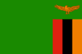
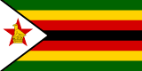
As the GeoFact of the Day Blog's Z Countries post reveals, there are two countries with names starting with the letter Z. ZAIRE was another Z country until 1997, the year it was renamed Democratic Republic of the Congo. A much smaller and short-lived country than Zaire, ZANZIBAR lasted less than one year (in 1964) before merging with Tanganyika to create Tanzania. Zambia and Zimbabwe flag images below come from Flagpedia.net; Zaire and Zanzibar flag images are derived from Wikipedia images.
ZAMBIA
 ZIMBABWE
 Flags of Former Z Countries
ZAIRE
ZANZIBAR
Flags of Former Z Countries
ZAIRE
ZANZIBAR
There are sixteen countries with Z in their names. Two countries start with the letter Z: Zambia and Zimbabwe. Other countries with the letter Z in their names are Azerbaijan, Belize, Bosnia and Herzegovina, Brazil, Czech Republic, Kazakhstan, Kyrgyzstan, Mozambique, New Zealand, Swaziland, Switzerland, Tanzania, Uzbekistan, and Venezuela. Zaire was a former Z country, but that became the Democratic Republic of the Congo.
 The A to Z categories are based on the English language and inadvertently might not include all native country names.
Neighbors in both the alphabet and geography, ZAMBIA and ZIMBABWE are located in Southern Africa. Both countries share the famous Victoria Falls, which lie on their borders along the Zambezi River. The magnificent waterfalls are located south of Livingstone, Zambia and east of Victoria Falls, Zimbabwe.
ZHŌNGGUÓ (China) could be considered as an additional Z country. This country is also featured in the C Countries post.
GeoFact of the Day Blog Post Links
Zambia — Zimbabwe — Zhōngguó
The largest preserved area of land in ZIMBABWE, a country in Southern Africa, is the Hwange National Park. It is located in the western part of the country, and its southwest extent borders the country of Botswana. A world-renowned landmark is located nearby: the Victoria Falls, located northwest at the border with Zambia. Communities surrounding Hwange National Park include Hwange (that was definitely not a surprise!), Dete, Gwai, Gwayi River, Lupane, Matetsi, and Mpandamatenga in Botswana.
Quite a few capitals previously had different names. The following is a list of many, definitely not all, of the capitals that had different names in the past — they are categorized by continent.
AFRICA
Bujumbura, BURUNDI's former capital (Gitega is the new capital since 2019), was called Usumbura until 1962.
N'Djamena, CHAD's capital, was called Fort Lamy until 1973.
Kinshasa, DEMOCRATIC REPUBLIC OF THE CONGO's capital, was called Léopoldville until 1966.
Banjul, the capital of GAMBIA, was named Bathurst until 1973.
Antananarivo, MADAGASCAR's capital, was named Tananarive until 1975.
Maputo, MOZAMBIQUE's capital, was named Lourenço Marques until Mozambique's independence in 1976.
Harare, ZIMBABWE's capital, was named Salisbury until 1982.
ASIA
Tbilisi, GEORGIA's capital, was known as Tpilisi (Georgian) or Tiflis (Russian) until 1936.
Jakarta, INDONESIA's highly-populated capital, was known as Sunda Kelapa, then Jayakata, then Batavia, then Djakarta from 1949 to 1972.
Tokyo, JAPAN's capital located on the island of Honshu, was previously named Edo until 1868.
Astana, KAZAKHSTAN's capital, was known as Tselinograd, then Aqmola.
Bishkek, KYRGYZSTAN's capital, was named Pishpek until 1926 and Frunze until 1991, the fall of the Soviet Union.
Ulaanbaatar, MONGOLIA's capital, was known as Ugra until 1924.
Dushanbe, TAJIKISTAN's capital, was called Dyushambe until 1929 and received the name Stalinagrad until 1961.
Ankara, TURKEY's capital, was called Angora until 1930.
Ashgabat, TURKMENISTAN's capital, was called Poltoratsk from 1919 until 1927.
EUROPE
Belgrade, SERBIA's capital, was known as Singidunum in ancient times.
Podgorica, MONTENEGRO's capital, was known as Birziminium before the 11th century, Ribnica during the Middle Ages, and Titograd from 1946 to 1992. The capital possessed the name Podgorica in 1326 until 1946, resuming in 1992.
SOUTH AMERICA
Sucre, one of two capitals of BOLIVIA and named in honor of Antonio José de Sucre, was called Chuquisaca until 1825.
Credit goes to the New Oxford American Dictionary, 2nd Edition, which conveniently listed former capital names.
Located in southern Africa, ZIMBABWE borders 5 countries: Botswana, Mozambique, Namibia, South Africa, and Zambia. Zimbabwe's border with Namibia is very tiny; look on a map, and you'll find the border is like a point! The capital is Harare. To learn more about Zimbabwe, visit my Zimbabwe post!

 Officially known as the Republic of Zimbabwe, ZIMBABWE is a landlocked country located in Southern Africa. Zimbabwe borders five countries: Botswana located to the southwest, Mozambique to the east, South Africa to the south, and Zambia to the north. Zimbabwe almost borders Namibia to the west. Along the Zimbabwe-Zambia border, the country possesses part of Lake Kariba, the Zambezi River, and the magnificent Victoria Falls. Zimbabwe’s former currency was the Zimbabwean Dollar, which had an ISO currency code of ZWL. Due to hyperinflation, Zimbabweans were and still are using other currencies to complete transactions. In June 2015, the Central Bank officially withdrew the currency from circulation. Zimbabwe is the world’s last country in alphabetical order!
● ● ● ● ● People and Places ● ● ● ● ● Over 11.652 million residents live in Zimbabwe, while 1,190,000 urbanites live in the national capital: Harare. Other major cities include Bulawayo (population: 622,000), Chitungwiza (275,000), Gweru (125,000), Hwange, Masvingo, Mutare (132,000), and Shurugwi. While Zambia is known for its diverse variety of ethnic groups, Zimbabwe is predominantly shared between Shona (over 80%) people, Ndebele (14%) people, and several other minority groups. About twenty-one major languages are used for communication — including two (Barwe and Tsoa) that are facing a threatened existence in the future. Languages include Chichewa, Dombe, Kalanga, Kunda, Lozi, Manyika, Nambya, Ndau, Ndebele, Shona, Tonga, Tswana, and Venda. Zimbabwe's literacy rate is relatively high (84%) in Africa. About 70% of religious Zimbabweans are Christians and 0.75% are Muslims. About 30% of Zimbabweans adhere to native beliefs and customs.
Great Zimbabwe (southeast Zimbabwe) and Dhlo-Dhlo (south-central Zimbabwe) are two ancient Shona civilization sites with still-standing stone walls and towers. Standing about 10.05 meters and 33 feet tall in Great Zimbabwe, the prominent conical tower is attached to walls of the Great Enclosure — known as the largest pre-colonial structure in Sub-Saharan Africa. Another ancient site and tourist attraction is located at Khami, a current UNESCO World Heritage Site and ancient capital of the Kingdom of Butua — organized by the ancestors of Kalanga (Shona-related) people. Zimbabwe’s national parks include Chewore Game Preserve (north), Chizarira NP (northwest), Gonarezhou NP (southeast), Hwange NP (west), Kazuma Pan (west), Mana Pools NP (north), Matabo NP (southwest), Matusadona NP (NW), Mtarazi Falls NP (east), and Zambezi NP (Zimbabwe’s western tip).
● ● ● ● ● Land Features ● ● ● ● ● Zimbabwe’s major waterfalls are on opposite sides of the country. People can find the Mtarazi Falls and Pungwe Falls in eastern Zimbabwe, while tourists would want to visit western Zimbabwe to witness the world-famous Victoria Falls. There’s more than waterfalls in Zimbabwe! Non-water land features include the northern Chinhoyi Caves, northwestern Chizarira Hills, central Mafungabusi Plateau, southern Mateke Hills, eastern Mavuradonha Mountains (near NW Mozambique), and northern Zambezi Escarpment. The Chinhoyi Caves are located about 150 kilometers northwest of Harare, while the Zambezi Escarpment is further north and runs westward into Zambia. Located in eastern Zimbabwe near Mozambique, Mount Nyangani is Zimbabwe's highest peak and stands 2,592 meters and 8,504 feet in elevation. Nyangani is comprised of harder dolerite and softer sandstone.
This post was updated with more information in September 2016. GeoFact of the Day’s map of Zimbabwe was designed in December 2022.
Blog Content
● The author of this GeoFact of the Day Blog creates and curates original, authentic content and posts information based on established facts. Blog posts are not generated by artificial intelligence (AI) but published by the author.
● Content and image graphics from other sources are properly credited. Many geography facts are well-established and therefore do not belong to any one source, but occasionally a fact requires attribution/credit if it is unique and hard-to-find — for example, facts found from specific cultural, anthropological, geological, and scientific (etc.) research.
● I do not copy and paste from other websites. Therefore, all posts are original but may sometimes include information, links, and/or images from credited external sources. To use a GeoFact of the Day Blog image for your website or project, write a comment below a post — then I may approve your request.
● Feel free to offer comments, suggestions, and compliments on any post or page! You can be anonymous. Spam comments with non-relevant links will be deleted.
● Thanks for your loyal readership on the educational and reliable GeoFact of the Day Blog, in existence since 2008!


