Search for Posts, Maps, and Topics

In this fourth episode of The Amazing Race Season 38 (U.S. Edition), teams left Prague and boarded one of two train routes that either went through eastern AUSTRIA 🇦🇹 or western SLOVAKIA 🇸🇰 in order to reach Budapest, the national capital of HUNGARY 🇭🇺. Teams arrived at the Széchenyi Thermal Baths to search for a king chess piece. Teams then gave it to locals who were swimming and playing chess on a floating platform in a large pool. After completing this task first, Eric and Tucker encountered a Fast Forward. They decided to complete the Fast Forward and both solved a Rubik’s Cube in less than 7½ seconds after much practice. Kudos to them because I don’t remember if I ever solved a Rubik’s Cube — or maybe I completed it in several days! Due to the Fast Forward, they quickly surpassed the competition and arrived at the Pit Stop: Várkert Bazár (Castle Garden Bazaar), a neo-Renaissance style promenade near the Royal Palace and Danube riverfront in Buda. The historic site was closed in the 1980s and sat neglected until a beautiful restoration in 2014.
For arriving in first place at this Pit Stop, Eric and Tucker won a trip to BOLIVIA 🇧🇴 including stops at the city of La Paz, the largest salt flat in the world (↗) (Uyuni, also known as Tunupa), and Charquini Mountain. Meanwhile, teams carefully steered a carriage with two horses along a figure eight course in less than 45 seconds. Next, teams arrived at the House of Houdini to unlock a chained wooden container — reminiscent of Harry Houdini’s escapist stunts but without the danger. Finally, teams chose either the “Juggling Act” or “Balancing Act” Detour task. For Juggling Act, teams juggled five rings and had to keep them dangling in midair for ten seconds. For Balancing Act, teams practiced and performed a folk dancing routine. One team member balanced a bottle on his or her head, while the other teammate maneuvered a large stick. Kat had trouble completing her routine but nevertheless persisted even though she was the last performer at the Detour. Therefore, Alex and Kat arrived last at the Pit Stop and ended their Amazing Race journey.
The next episode was on Wednesday, October 22nd at 9:30 p.m. Eastern Time on CBS. The episode 5 recap will be posted in several days.
A new and detailed map of AUSTRIA on the GeoFact of the Day Blog provides locations of cities/towns, landscape features, terrain, and country borders. Visit the Austria post (↗) to enjoy the newest addition to GeoFact of the Day's cartographic collection! To tell me what you think about this map, comment down below or send an email! What country or other place should be the focal point of my next map?
The following produce and materials are major exports of AUSTRIA: antimony, chemicals, coal, dairy products, equipment and machinery, fabricated metal products, foodstuffs and processed food, fruit, grain, graphite and magnesite, iron, lumber, motor vehicles and parts, paper and paperboard, potatoes, salt, steel, textiles, and wine. According to the International Monetary Fund (data.imf.org), countries and territories buying and importing most of those exports in 2016 include Germany (top importer), the United States, Italy, Switzerland, Slovakia, France, Czech Republic, Hungary, the United Kingdom, Poland, China, Slovenia, Spain, the Netherlands, Romania, Russia, Belgium, Sweden, Turkey, and Japan.
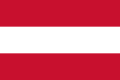
The 2:3 ratio flag of AUSTRIA in south-central Europe was adopted in 1945 after having a Nazi flag for seven years. When the Nazis from Germany annexed Austria starting in March 1938, the country was called Ostmark. Fortunately, Austria eventually gained its independence from the Nazis in 1945. Like multiple European countries, Austria has a flag with three stripes. They are horizontal and of equal height; white is the middle stripe and red are the top and bottom stripes. According to Vexilla Mundi, the use of one white bands and two red bands for the national flag dates back to the year 1869, when Austria was part of Austria-Hungary (Austro-Hungarian Empire). The naval and merchant ensign of the Habsburg Empire incorporated the same flag colors starting in the year 1786 and continued when the empire became Austria-Hungary. However, left of center on that flag was a monarchial coat of arms featuring a gold-trimmed shield with crown on top. The Republic of German Austria (1918-9) had the same flag as Austria's current flag, and the Republic of Austria (1919-38) had an eagle coat of arms on top of the white and red background. Flag image credit: Flagpedia.net
As of July 7th, 2014, the IUCN Red List of Threatened Species™ lists 41 endangered and 25 critically endangered species in AUSTRIA (learn more about Austria with my post). Since the IUCN's beginning, the Red List declares 3 extinct species that were on the Red List. One of the three extinct species is the Belgrandiella intermedia freshwater snail. The other two extinct species in Austria are fish. The Deepwater Char and Lake Constance Whitefish were formerly endemic in Lake Constance, bordered by Austria, Germany, and Switzerland.
The important Danube River stretches for almost 2,000 miles in Central and Southeast Europe. It begins its journey in Southern GERMANY and then flows eastward, passing by German cities like Ingolstad, Regensburg, and Straubing. The Danube then crosses AUSTRIA, passing by cities like Linz and Vienna (Austria's capital). Next, it forms part of SLOVAKIA's southern border and HUNGARY's northern border, passing cities like Győr, Komárom, and Esztergom in Hungary and Slovakia's capital, Bratislava. The river takes a 90 degree turn towards Budapest (Hungary's capital) and heads straight down through Hungary until meeting up with SERBIA's northwest border. It then travels east through the northern part of Serbia, running by cities like Backa Palanka, Novi Sad, and Belgrade (Serbia's capital). The Danube then forms most of ROMANIA's southern border and BULGARIA's northern border. Finally, it crosses the eastern part of Romania and ends at the Black Sea delta.

AUSTRIA, a Central European county straddled in the pristine Alps mountain range, is divided up into nine states, which are locally known as Bundsländer (plural): Burgenland, Kärnten (Carinthia), Niederösterreich (Lower Austria), Oberösterreich (Upper Austria), Salzburg, Steiermark (Styria), Tirol (Tyrol), Vorarlberg, and Wien (Vienna). There are fifteen statutory cities in Austria; Austria's capital, Vienna (locally known as Wien), is actually both a statutory city and a state. The only state that does not have at least one statutory city is Vorarlberg, in the westernmost part of Austria's horizontal panhandle. Within the nine states, there are a total of 84 political districts, shown in my map as the thin light blue borders. The number of districts does not include the smaller-in-area statutory cities. For example, Innsbruck is a statutory city, while the surrounding Innsbruck Land is a district. Like my maps of the administrative divisions of Bhutan and Poland, I thank the website Global Administrative Areas (GADM.org) for the shapefiles that were used to create this map.
Located in western AUSTRIA, the Brenner Pass is situated on the southern border with northern Italy at a height of 4511 feet (about 1375 meters). While it is the lowest in comparison to other main Alpine passes, it is a mountain route that has been used since the Roman years. The first true road was built in 1772.
The Inn River is a tributary of the important Danube River in Central Europe. It flows predominantly through AUSTRIA, more specifically in the western 'panhandle' and as a part of the northern border with Germany. It originates in the Swiss Alps in eastern SWITZERLAND and flows into the Danube River at Austria's northern border. Fittingly, the city of Innsbruck is situated on the shores of the Inn River, in western Austria.

Click the image to enlarge it in a pop-up lightbox window.
Locally known as Österreich, AUSTRIA is a landlocked country in Central Europe that boasts mountain ranges — the main one being the Central Eastern Alps, also called the Austrian Alps — that cover two-thirds of the country's total area. Austria is north of Italy and Slovenia, south of Germany and Czech Republic, west of Hungary and Slovakia, and east of Switzerland and the tiny nation of Liechtenstein. The capital of Austria is Vienna (Wien), the largest city that largely owes its importance and population to the Danube River. Other cities in Austria include Graz, Innsbruck, Linz, and Salzburg. The citizens of Austria use the Euro; the old currency was the Austrian Shilling, which went out of circulation in 2002.
Blog Content
● The author of this GeoFact of the Day Blog creates and curates original, authentic content and posts information based on established facts. Blog posts are not generated by artificial intelligence (AI) but published by the author.
● Content and image graphics from other sources are properly credited. Many geography facts are well-established and therefore do not belong to any one source, but occasionally a fact requires attribution/credit if it is unique and hard-to-find — for example, facts found from specific cultural, anthropological, geological, and scientific (etc.) research.
● I do not copy and paste from other websites. Therefore, all posts are original but may sometimes include information, links, and/or images from credited external sources. To use a GeoFact of the Day Blog image for your website or project, write a comment below a post — then I may approve your request.
● Feel free to offer comments, suggestions, and compliments on any post or page! You can be anonymous. Spam comments with non-relevant links will be deleted.
● Thanks for your loyal readership on the educational and reliable GeoFact of the Day Blog, in existence since 2008!


