Search for Posts, Maps, and Topics

1) Which answer choice is not a traditional name and meaning of Mount Everest?
A — Pittiputhisetrimadayinokki (“towering pillar of the cosmos”)
B — Sagarmatha (“head of the Earth touching heaven”)
C — Chomolungma (“goddess mother of the world”)
2) True or false: Minted in the year 1999, a gold commemorative coin issued by TÜRKIYE displays a denomination of 60,000,000 Lira.
3) Which gemstone is oftentimes the top export of the CENTRAL AFRICAN REPUBLIC?
A — topaz
B — diamond
C — emerald
D — sapphire
ANSWERS
Question 1:
A . . . . . Pittiputhisetrimadayinokki (“towering pillar of the cosmos”)
Sidenote: The technically correct pronunciation of Mount Everest should be “eve-rest” instead of “ever-est,” based on how George Everest’s surname was pronounced. Therefore, the first syllable would rhyme with “sleeve” rather than “never.”
Question 2:
True
Question 3:
B . . . . . diamond

“Gently Down the Stream” Episode Description: Teams continue racing through Corsica, France, where each team member must try a piece of casu martzu.
Episode Airdate: Wednesday, February 9th, 2022 on CBS
On this episode of the The Amazing Race, teams remained on the island of Corsica — located southeast of mainland FRANCE but geographically closer to ITALY and Italy’s Sardinia island. After teams slept overnight in tents near the banks of the Tavignano river…
● They left Cardiccia and drove T-Roc convertibles south to the Tour de Fautea watchtower overlooking the Mediterranean Sea. The previous episode and this episode both involve a dairy-related challenge. As the episode description indicates, every remaining contender in this season had to partake in eating casu martzu — let’s just say this cheese is not the most appetizing option available in the world! Lala, Lulu, and others were understandably gagging while trying to chow down the casu martzu. After entirely eating the mortifying morsel, teams encountered a…
● Detour, choice between “Row, Row, Row Your Boat” or “Gently Down the Stream”: teams choosing the Row, Row option sailed in a transparent kayak and sought to unhook and gather ten fish decoys from the water. Teams then exchanged the fish for a clue. After catching eight of ten fish, Dusty and Ryan capsized when the kayak sunk and filled with water; they recovered the kayak and their fish and subsequently found the other two. The second Detour option includes the same style of colorful fish decoys, which are likely made of metal or plastic (or something else). Teams choosing the Gently Down the Stream option boarded an Aquavision tour boat, which resembles a submarine since passengers can look underwater at the landscape and aquatic life surrounding them. Teams memorized which fish decoys they saw in chronological order then chose the pictorial card containing the correct order of fish. Teams noted some of the fish by their resemblance to national flags: France (vertical blue/white/red stripes), Jamaica (green/gold/black), and Japan (white fish with red spot).
● After completing the fishy Detour, teams visited the marina (port de plaisance) in Bonifacio. Bonifacio is a community of more than 3,000 residents in the southernmost area of Corsica, although several places such as the Pertusato Lighthouse and the islands of Cavello, Lavezzu, and Piana (not to be confused with a Piana island off the northwest coast of Sardinia) are more southerly and southeasterly. In Bonifacio, teams encountered this episode’s…
● Roadblock (“Who’s Feeling Knotted Up?”): alongside the harbor on a wide sidewalk, one member on each team fixed the large gaping hole in a fishing net with the help of string and a knotting technique. Completing this Roadblock yielded a clue directing teams to spot the man dressed as emperor Napoleon Bonaparte, and he would then lead teams to the apex of the chalky and picturesque…
● Pit Stop: Bonifacio Cliffs — 200 feet above the Mediterranean Sea
Season 33, Episode 7 Results
1st — Kim and Penn [same as previous episode]
1st place prize — vacation to TURKEY
2nd — Cayla and Raquel [same as previous episode]
3rd — Dusty and Ryan [same as previous episode]
4th — Lala and Lulu
5th — Arun and Natalia
Eliminated from the competition? No; non-elimination leg
People all across TURKEY recently celebrated their country's Republic Day on Thursday, October 29th. Turkey achieved independence from the Ottoman Empire in 1923. Happy belated Republic Day!
Name at least two countries that directly border the Black Sea in Eastern Europe.
All possible answers are listed below!
...
...
...
...
...
...
...
Possible answers:
BULGARIA
GEORGIA
ROMANIA
RUSSIA
TURKEY
UKRAINE
(MOLDOVA does not quite border the Black Sea, although it does have access to the Black Sea via a port along the Danube River.)
According to National Geographic MapMaker (mapmaker.nationalgeographic.org), the following items are major exports of TURKEY: antimony, automobiles, barite, borate, chromium, citrus fruit, clay, clothing and textiles, coal, copper, cotton, electronics, emery, feldspar, gold, grain, hazelnuts, iron ore, limestone, magnesite, marble, mercury, metal products (especially steel), olive oil, olives, packaged food, perlite, petroleum, pulses, pumice, strontium, sugar beets, sulfur, tobacco, transportation equipment, and wood. According to February 2017 statistics from the International Monetary Fund (data.imf.org), countries and territories buying and importing most of those exports include Germany (top importer), the United Arab Emirates, Iraq, the United Kingdom, Italy, the United States, France, Spain, Iran, the Netherlands, Israel, Poland, Saudi Arabia, Romania, Belgium, Egypt, Bulgaria, China, Russia, Algeria, Greece, Syria, Morocco, Sweden, and Ukraine.
Yesterday on April 25th, AUSTRALIA and NEW ZEALAND celebrated the 102nd anniversary of Anzac Day. This annual day commemorates the service of all veterans who served and are serving in wars and peacekeeping missions. By the way, ANZAC is an acronym for Australian and New Zealand Army Corps. Australians and New Zealanders (Kiwis) first observed the holiday in 1916 — in order to memorialize binational troops arriving at Gallipoli (TURKEY) to fight in World War I against the Ottoman Empire.

Towns and Geography
Located in the western section of western TURKEY's Sea of Marmara, Marmara island (Marmara Adası in the Turkish language) is sparsely populated overall, and much of it is still forested land. The island is also located north of several smaller islands and northwest of Kapidaği Peninsula. Main settlements and communities border the Sea of Marmara on the oval-shaped island's western, southern, and eastern coastline. Clockwise (from northeast to south to west), the cities and towns of Marmara island include Saraylar, Asmali (Asmalı), Topağaç, Gündoğdu, Marmara, and Çinarli (Çınarlı).
Northwestern TURKEY's nine Prince Islands (Prens Adaları in the Turkish language), also known as Princes' Islands, are situated in the northwestern part of the Sea of Marmara (Marmara Denizi). These islands boast archaeological ruins dating back to the Archaic Period and Byzantine Period, hundreds and even thousands of years ago. From the west to east, the islands are Sivriada, Democracy and Freedom Island (Demokrasi ve Özgürlükler Adası), Kınalıada, Burgaz Adası, Spoon Island (Kaşik Adası), Heybeliada, Balıkçı Adası, Büyükada, and Sedef Adası.
The smallest islands - which are Balıkçı Adası, Democracy and Freedom Island, and Sivriada - are not inhabited by humans. Additionally, the picturesque landscapes of Balıkçı Adası and Sivriada are virtually untouched. Previously called Yassıada until late 2013, Democracy and Freedom Island contains a complex of derelict and dilapidated buildings, reminiscent of the 1960s trial and arrest of Prime Minister Adnan Menderes on the island. There are plans to build a democracy museum and conference center on Democracy and Freedom Island, as well as possible developments on Sivriada island.
Between Burgaz Adası and Heybeliada, Balıkçı Adası is a privately-owned island developed with a couple of noticeable piers. Büyükada is the largest island of the Prince Islands archipelago and is north of the smallest island in the bunch: Balıkçı Adası. The Prince Islands are southeast of Turkey's capital, Istanbul, and south of the following communities: Kadiköy, Kartal, Mattepe, and Pendik.
While the main section of AZERBAIJAN is separated from TURKEY by Armenia, Turkey does have a border with Azerbaijan - more specifically with a region known as Naxçivan. Officially named Naxçıvan Muxtar Respublikası in the Azerbaijani language, Naxçivan is an autonomous republic serving as Azerbaijan's largest exclave area. Turkey's far eastern border with Naxçivan is only about 6.2 miles or 9.98 kilometers long. To the left of the border is a Turkish panhandle surrounded by Iran to the south, Armenia to the north, and Naxçivan to the east and southeast. Mount Ararat is about 30 kilometers west of Turkey's border with Naxçivan.
Quite a few capitals previously had different names. The following is a list of many, definitely not all, of the capitals that had different names in the past — they are categorized by continent.
AFRICA
Bujumbura, BURUNDI's former capital (Gitega is the new capital since 2019), was called Usumbura until 1962.
N'Djamena, CHAD's capital, was called Fort Lamy until 1973.
Kinshasa, DEMOCRATIC REPUBLIC OF THE CONGO's capital, was called Léopoldville until 1966.
Banjul, the capital of GAMBIA, was named Bathurst until 1973.
Antananarivo, MADAGASCAR's capital, was named Tananarive until 1975.
Maputo, MOZAMBIQUE's capital, was named Lourenço Marques until Mozambique's independence in 1976.
Harare, ZIMBABWE's capital, was named Salisbury until 1982.
ASIA
Tbilisi, GEORGIA's capital, was known as Tpilisi (Georgian) or Tiflis (Russian) until 1936.
Jakarta, INDONESIA's highly-populated capital, was known as Sunda Kelapa, then Jayakata, then Batavia, then Djakarta from 1949 to 1972.
Tokyo, JAPAN's capital located on the island of Honshu, was previously named Edo until 1868.
Astana, KAZAKHSTAN's capital, was known as Tselinograd, then Aqmola.
Bishkek, KYRGYZSTAN's capital, was named Pishpek until 1926 and Frunze until 1991, the fall of the Soviet Union.
Ulaanbaatar, MONGOLIA's capital, was known as Ugra until 1924.
Dushanbe, TAJIKISTAN's capital, was called Dyushambe until 1929 and received the name Stalinagrad until 1961.
Ankara, TURKEY's capital, was called Angora until 1930.
Ashgabat, TURKMENISTAN's capital, was called Poltoratsk from 1919 until 1927.
EUROPE
Belgrade, SERBIA's capital, was known as Singidunum in ancient times.
Podgorica, MONTENEGRO's capital, was known as Birziminium before the 11th century, Ribnica during the Middle Ages, and Titograd from 1946 to 1992. The capital possessed the name Podgorica in 1326 until 1946, resuming in 1992.
SOUTH AMERICA
Sucre, one of two capitals of BOLIVIA and named in honor of Antonio José de Sucre, was called Chuquisaca until 1825.
Credit goes to the New Oxford American Dictionary, 2nd Edition, which conveniently listed former capital names.
The capital of TURKEY is Ankara, not Istanbul! Many would think that Istanbul is the capital; after all, it is the largest city in Turkey. They would be correct in saying that Istanbul has served as the capital 'back in the day' in ancient times. To learn more about Turkey, visit my Turkey post!

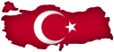 Officially known as Türkiye Cumhuriyeti or the Republic of Turkey, TÜRKIYE (Turkey) is a geographically diverse and predominantly Islamic country that straddles two continents. A small peninsula is in Europe, and the rest of the mainland is in Asia. Turkey borders seven countries: Bulgaria, Greece (both in Europe), Armenia, Iran, Iraq, Georgia, and Syria (the latter countries are in Asia). The capital is Ankara, which is the second largest city in Turkey. Istanbul, which developed alongside the Bosporus (also known as Istanbul Strait or İstanbul Boğazı), is the largest city and is often mistakenly thought of as Turkey's capital. Located close to the border with Azerbaijan, Mount Ararat (5137 meters, or 16,854 feet) is the highest peak. Turkey's currency is the Turkish Lira, and its ISO 4217 currency code is TRY.
Blog Content
● The author of this GeoFact of the Day Blog creates and curates original, authentic content and posts information based on established facts. Blog posts are not generated by artificial intelligence (AI) but published by the author.
● Content and image graphics from other sources are properly credited. Many geography facts are well-established and therefore do not belong to any one source, but occasionally a fact requires attribution/credit if it is unique and hard-to-find — for example, facts found from specific cultural, anthropological, geological, and scientific (etc.) research.
● I do not copy and paste from other websites. Therefore, all posts are original but may sometimes include information, links, and/or images from credited external sources. To use a GeoFact of the Day Blog image for your website or project, write a comment below a post — then I may approve your request.
● Feel free to offer comments, suggestions, and compliments on any post or page! You can be anonymous. Spam comments with non-relevant links will be deleted.
● Thanks for your loyal readership on the educational and reliable GeoFact of the Day Blog, in existence since 2008!


