


Maps are categorized by continent and were illustrated with the latest GeoFact of the Day design layout. The large maps of country's administrative districts are not featured in this slideshow feature, although they can be accessed with the Regions and States post label (↗).
Some Maps (Newest to Oldest)
Click a box below to open a post (featuring its map) in a new tab or window!
Africa
Algeria (2015), Angola (2019), Benin (2019), Botswana (2020), Burkina Faso (2017), Burundi (2020), Cabo Verde [Cape Verde] (2012), Cameroon (2020), Central African Republic (2020), Comoros (2011), Lesotho (2012), Madagascar (2019), Namibia (2020), Rwanda (2026), South Sudan (2011), Sudan (2013), Zambia (2017), and Zimbabwe (2022)
Miscellaneous: Algeria's Provinces (Wilayas) (2013), Angola's Provinces (2015), Drakensberg Mountains (2012), Lesotho's Districts (2013), Raas Xaafuun Peninsula (2013), and Togo's Admin. Divisions (2013)


Asia
Bangladesh (2023), Bhutan (2011), Brunei (2016), Cambodia (2012), China (2022), Israel (2013), Japan (2011), Kyrgyzstan (2011), Macau (2015), Malaysia (2011), Mongolia (2015), Oman (2023), Pakistan (2012), The Philippines (2013), Qatar (2013), Saudi Arabia (2012), Singapore (2013), Tajikistan (2017), and Yemen (2014)
Miscellaneous: Bhutan's Districts (2013), Japan's Peninsulas (2015), Kyrgyzstan's Enclaves (2011), and the Sea of Marmara (2012)


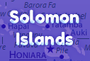
Australia and Oceania
Australia (2011), Fiji (2013), Kiribati (2016), Marshall Islands (2017), Micronesia (2017), Nauru (2023), New Zealand (2013), Palau (2013), Papua New Guinea (2017), Samoa (2016), Solomon Islands (2014), Tonga (2017), Tuvalu (2017), and Vanuatu (2017)


Europe
Albania (2013), Andorra (2015), Austria (2021), Belgium (2021), France (2016), Germany (2011), Ireland (2011), Kosovo (2017), Liechtenstein (2016), Moldova (2012), San Marino (2016), Serbia (2011), Slovenia (2016), Spain (2011), United Kingdom (2011), and Vatican City (2016)
Miscellaneous: Albania's Admin. Divisions (5/23/13), Andorra's Parishes (6/8/13), Austria's Districts (5/1/13), Poland's Population Density (4/29/13), Poland's Provinces (4/25/13), and Trajan's Walls - Moldova (10/1/12)


~ Maps of European Islands
These islands are located in the Atlantic Ocean, and Mediterranean Sea, and other water bodies around Europe. European island countries (like Ireland) are listed above under Europe.
DENMARK: Faroe Islands (5/20/13)

FRANCE: Corsica (1/21/11)

GREECE: Crete (2/11/11), Cyclades (3/1/11), Dodecanese Islands (3/20/11), Ionian Islands (6/7/11), Northern Sporades (8/1/11), and Saronic Islands (7/19/11)


ITALY: Sardinia (1/21/11) and Sicily (2/26/11)


SPAIN: Balearic Islands (1/27/11) and Canary Islands (6/5/14)


UNITED KINGDOM: Channel Islands (2/12/12), Hebrides (12/17/12), Isle of Man (2/25/12), Orkney Islands (6/26/12), and Shetland Islands (5/24/12)


Indian Ocean Territories
These islands, which are possessions of other countries, are located in the Indian Ocean. Both of the islands listed, Réunion and Mayotte, belong to France.
Mayotte (7/29/12) and Réunion (10/14/11)


North America (with Caribbean Sea Countries)
Aruba (2011), Prince Edward Island (2013), Saint Lucia (2011), Turks and Caicos Islands (2012), and the U.S. Virgin Islands (2011)
Miscellaneous: Grand Lake, Ohio - United States (7/6/2015)
Antigua & Barbuda Parishes (5/24/16), Bahamas Districts (6/13/16), Barbados Parishes (5/25/16), Cuba Provinces (6/28/16), Dominica Parishes (5/26/16), Dominican Republic Provinces (7/6/16), Grenada Parishes (5/27/16), Haiti Departments (7/8/16), St. Kitts & Nevis Parishes (6/2/16), St. Lucia Districts (6/2/16), St. Vincent & the Grenadines Parishes (6/3/16), Trinidad & Tobago Regions (6/6/16)


South America
Brazil (8/17/2016) and Colombia (7/25/2016)
Miscellaneous: Suriname's Border Disputes (1/9/2013)


No comments:
Post a Comment