Search for Posts, Maps, and Topics

Click here to enlarge the map in a new window. This map is available in a wall-poster size courtesy of Eric Olason at Maps.com.
 LIBYA (ليبيا) is an oil-producing country in Northern Africa and located south of the Mediterranean Sea. There are 6 bordering countries: Algeria, Chad, Egypt, Niger, Sudan, and Tunisia. The capital is Tripoli, known as Ṭarābulus in the Arabic language. Other cities in Libya include Benghazi, Darnah, Misratah, Sabratah, and Tobruk. Most of Libya's cities are found along the Mediterranean coastline. Libya's historic regions and provinces are Tripolitania in the northwest, Cyrenaica in the east and southeast, and Fezzan in the southwest. Sirtica is another historic region in between Cyrenaica and Tripolitania. It is also a major oil-producing center.
The Sahara desert extends across central and southern Libya. From north to south, the Libyan Plateau, the Great Sand Sea and Libyan Desert all straddle the border between eastern Libya and western Egypt. North of north-central Libya lies the Mediterranean Sea's Gulf of Sidra. Libyans use the Libyan Dinar as their currency, and the ISO 4217 currency code is LYD.

 Known as مِصر (Miṣr) in the Arabic language, EGYPT is a well-known, predominantly Muslim country located in North Africa. Egypt borders the Mediterranean Sea along its northern coast, and of course this country is known for its ancient history and structural wonders. The pyramids of Egypt are certainly remarkable architectural feats, and the methods in which ancient Egyptians built them were revolutionary and more efficient than ever before. There are 3 bordering countries: Israel located to the east and northeast, Libya to the west, and Sudan to the south. The capital is Cairo, with more than 10 million residents and growing. The currency is the Egyptian Pound, and its ISO 4217 currency code is EGP.

● ● ● ● ● People and Places ● ● ● ● ● The total population of Yemen is about 27 million, according to a 2014 estimate. Population growth is quite rapid because the 2000 population was 10 million less than the current population! Yemen's capital and largest city is Sanaa, which is also spelled Şan'ā' or Sana. Sanaa's population is over 1.7 million while the metropolitan population is at least 2.3 million. Other Yemeni cities include Aden ('Adan), Al Hudaydah, Al Mukallā, Damqawt, Hisn al 'Abr, Mocha, Qishn, Saywūn, and Ta'izz. Most cities are clustered near major water features; cities such as Al Hudaydah and Mocha are located east of the Red Sea, while the other aforementioned cities except Hisn al 'Abr are found along or near the Gulf of Aden coast. Meanwhile, Hisn al 'Abr is found right in the middle of northern Yemen. The official language is Arabic, while the official religion is Islam. Arab is the dominant ethnic group, followed by Afro-Arab and South Asian. For their currency, Yemenis use the Yemeni Rial. The ISO 4217 code of their currency is YER.
● ● ● ● ● Land and Water Features ● ● ● ● ● Yemen is situated on the southern part of the large Arabian Peninsula. The Arabian Sea is southeast of Yemen, Gulf of Aden is south, and the Red Sea separates Yemen from Africa to the west. The narrow strait (bab in Arabic) between Yemen and the African countries of Djibouti and Eritrea is Bab el Mandeb. The semicircular gulf near the city of Al Ghaydah in eastern Yemen is Ghubbat al Qamar. There are multiple Yemeni islands in the Red Sea and Gulf of Aden. Socotra is Yemen's largest island and is located in the Gulf of Aden. Socotra has a variety of rare, endemic species. Standing at 12,336 feet (about 3,760 m), Jabal an Nabi Shu'ayb is the highest mountain in Yemen and on the Arabian Peninsula. The capital city Sanaa is located east of it. Ḩaḑramawt is a historical region and rugged terrain area in southern Yemen, dominated by mountains, cliffs, and valleys.
Yemen is the last Asian country in alphabetical order!
This post was updated May 28th, 2015.


 UNITED ARAB EMIRATES is a very wealthy and financially-developed Middle Eastern country. The U.A.E. is famous for its modern urban skyscrapers and unique artificial islands. As of a June 2015 update and since its construction in 2010, the Burj Khalifa building in the city of Dubai is still the tallest building in the world! Meanwhile, the World Islands and Palm Islands are located in the Persian Gulf (sometimes known as the Arabian Gulf) north of the country, off the coast of Dubai. The geographic location of the major islands goes from Palm Jumeirah to the left, the World Islands in the middle, and Deira Island archipelago to the right. The Palm Jebel Ali archipelago is partially built to the southwest of Palm Jumeirah. There are two bordering countries: Oman to the southeast and Saudi Arabia to the west. The capital is Abu Dhabi, spelled Abū Zaby (cedilla under the Z) in Arabic. The largest-populated city is Dubai. The currency is the United Arab Emirates Dirham (Emirati Dirham), and its ISO 4217 currency code is AED.

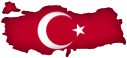 Officially known as Türkiye Cumhuriyeti or the Republic of Turkey, TÜRKIYE (Turkey) is a geographically diverse and predominantly Islamic country that straddles two continents. A small peninsula is in Europe, and the rest of the mainland is in Asia. Turkey borders seven countries: Bulgaria, Greece (both in Europe), Armenia, Iran, Iraq, Georgia, and Syria (the latter countries are in Asia). The capital is Ankara, which is the second largest city in Turkey. Istanbul, which developed alongside the Bosporus (also known as Istanbul Strait or İstanbul Boğazı), is the largest city and is often mistakenly thought of as Turkey's capital. Located close to the border with Azerbaijan, Mount Ararat (5137 meters, or 16,854 feet) is the highest peak. Turkey's currency is the Turkish Lira, and its ISO 4217 currency code is TRY.

 SYRIA is a Mediterranean and Middle Eastern country located to the east of the Mediterranean Sea and the small country Lebanon. Jordan is to the south, Türkiye is to the north, and Iraq is east of Syria. The capital of Syria is Damascus (Dimashq). The currency is the Syrian Pound, and its ISO 4217 currency code is SYP.
 The Arabian Peninsula's largest country at 2.15 million km² and 830,000 mi², the Kingdom of SAUDI ARABIA (Al-ʿArabīyah As-Saʿūdīyah, المملكة العربية السعودية) possesses majestic skyscrapers, wealthy royalty, deserts, oases, wadis (intermittent streams), and several remarkable mountain peaks and ranges. Saudi Arabia borders Iraq, Jordan, Kuwait, Oman, Qatar, United Arab Emirates, and Yemen and is west of Bahrain, a tiny island nation comprised of 33 islands. Saudi Arabia borders two bodies of water that are vital modes of exporting oil and other goods: the Red Sea (west) and the Persian Gulf (east). Saudi Arabia's currency is the Saudi Riyal, and its ISO 4217 currency code is SAR.
● ● ● ● ● People and Places ● ● ● ● ● Saudi Arabia's population is approaching near 30 million, according to a 2014 estimate. The capital and largest-populated city of Saudi Arabia is Riyadh, also spelled Ar Riyāḑ. Riyadh has over 5 million residents and various sites of interest including the Al Faisaliyah Center, Al Bujairi Square, Al Rajhi Grand Mosque, King Abdullah Park, Kingdom Centre Tower, Masmak Citadel, National Museum, and Wadi Hanifah.
Other major cities throughout Saudi Arabia include Abhā, Ad Dammam, Al Jawf, 'Ar'ar, At Ta'if, Buraydah, Ḥā'il, Jedda, Khamis Mushayt, Najrān, Sakakah, Sarurah, and Tabūk. Due to their pilgrimage sites and reverential religious history, Mecca and Medina are known as special holy cities according to Islamic tenets. Saudi Arabia's principal languages are Standard Arabic and Najdi Spoken Arabic. According to Ethnologue (↗), other major languages communicated throughout the kingdom include Bengali, Egyptian Spoken Arabic, English, North Levantine Spoken Arabic, Rohingya, Somali, Southern Balochi, Sudanese Spoken Arabic, Swahili, Tagalog, Turkish, Urdu, and Uyghur. Over 90% of Saudi Arabians are Muslims, followed by Christians (>5%), Hindus (>1%), Buddhists (0.33%), Sikhs (0.2%), and worshippers of ethnic religions (0.18%).
● ● ● ● ● Land and Water Features ● ● ● ● ● Standing at 3,133 meters (10,278 feet) in the Al Hijaz (Hejaz) mountain range, Jabal Sawda' is the highest point in Saudi Arabia, but not for all of the Arabian Peninsula — Jabal an Nabi Shu'ayb in Yemen takes that honor. The Rub' al Khali (Empty Quarter) is famous for being extremely arid and the largest interrupted sand desert on the globe, whereas deserts like the Sahara are somewhat divided up by mountain ranges and other features. Saudi Arabia is lacking when it comes to freshwater lakes, but there are plenty of wadis and oasis areas throughout the steamy-hot arid areas. Finally, the Sinai Peninsula of Egypt is separated by about 26 kilometers and 16 miles due to the Gulf of Aqaba. The Jabal Mazafah mountain range overlooks the water body from the Saudi Arabian side.
This post was comprehensively updated with more info on July 14th, 2017.

 QATAR is a relatively small, Middle Eastern country in western Asia with the highest GDP per capita in the world, according to 2013 data on the CIA World Factbook website. It is a peninsula projecting out into the Persian Gulf. The only bordering country is Saudi Arabia, which touches Qatar's southern border. The capital and largest-populated city of Qatar is Doha, spelled Ad Dawhah (cedilla under the first h) in Arabic. Even though the Hawar (Ḩawār) Islands are located very close to Qatar's west coast, they belong to Bahrain (↗), an island country located to the northwest. Speaking of islands, in satellite imagery you would notice on the eastern coast (above Doha) that there are several natural islands but also a developed, manmade island called The Pearl. A multi-lane bridge connects The Pearl and mainland Qatar. Ra's Rakan, an island also known as Jazīrat Ra's Rakan, is basically Qatar's small "hat" located at
  the top of the country. The currency is the Qatari Rial, and its ISO 4217 currency code is QAR.
Post updated with new map on December 3rd, 2013.
 OMAN is a Middle Eastern country bordering the Arabian Sea in the east and the Gulf of Oman in the north. It is east of the countries Saudi Arabia, United Arab Emirates (U.A.E.), and Yemen. The capital of Oman, located along the northern coast and north of the Al Hajar mountain range, is Muscat (also spelled Masqat). According to Encyclopædia Britannica, Oman’s population in the year 2020 is about 4,593,000 and is ranked 126th among populations of the whole world’s countries, dependencies, and territories. The currency is the Omani Rial, and its ISO 4217 currency code is OMR. Only a handful of countries have exclaves or a single exclave, and Oman has one in its northern extent on a peninsula. Exclaves are areas of land belonging to a particular country, but are separated from that country because of another. Sticking vertically into the Strait of Hormuz, the Musandam Peninsula of northern Oman serves as a boundary where the Persian Gulf - northwest of Oman and north of the U.A.E. - and Gulf of Oman meet. This is unusual: there is an exclave within an exclave, located between the Musandam Peninsula to the north and mainland Oman to the south. The Oman-occupied exclave is shaped like a doughnut, and here's why! A small area of U.A.E. land is surrounded by Oman territory, and that is then surrounded by the U.A.E.


 LEBANON is a Middle Eastern country located north of Israel. Syria borders Lebanon to the east, and the Mediterranean Sea is west. Lebanon's total population is about 4.5 million as of May 2015. The capital and most-populated city of Lebanon is Beirut, which has over 2 million residents. Other Lebanese cities include Juniyah, Sayda, Sur, Trâblous, and Zahlah. The currency is the Lebanese Livre, and its ISO 4217 currency code is LBP.

 KUWAIT is a relatively small, Middle-Eastern country located to the southeast of Iraq and northeast of Saudi Arabia. The population is over 3 million and growing steadily. The Persian Gulf borders eastern Kuwait. On the Persian Gulf coast, the capital of Kuwait is Kuwait City, spelled Al Kuwayt or al-Kuwayt in Arabic. The currency is the Kuwaiti Dinar, and its ISO 4217 currency code is KWD.

 Officially known as the Hashemite Kingdom of Jordan, JORDAN (الأردن) is a Middle Eastern country with a population near 6.7 million. Jordan's total area is 89,340 square kilometers and 34,495 square miles. Israel is located to the west of Jordan, and beyond Israel is the Mediterranean Sea. Saudi Arabia is southeast of Jordan and Syria is north, while the eastern panhandle of Jordan is west of Iraq. The capital of Jordan, located in the northern part of the country, is Amman ('Ammān). The currency is the Jordanian Dinar, and its ISO 4217 currency code is JOD.
 ISRAEL, the birthplace of global religions like Christianity and Judaism while being a hotspot for civil conflicts, is located in the Middle East. It border four countries; Egypt and its Sinai Peninsula is to the southwest, Jordan is to the east, Lebanon is north of Israel, and Syria borders Israel to the northeast. Israel's complete western coast borders the Mediterranean Sea. Seen as a light blue color to the east of northern Israel on my map, the GOLAN HEIGHTS is a region currently belonging to Israel but claimed by Syria. Palestinians have a small level of self-governance and autonomy in the GAZA STRIP and WEST BANK, but these areas are stricken by frequent conflicts between Israelis and Palestinians. Israel's currency is the Israeli New Shekel, and its ISO 4217 currency code is ILS. Previous currencies included the Israeli Lira (1952-1980) and (Old) Shekel (1980-1985). On May 14th, 1948, Jewish Agency chairman David Ben-Gurion declared independence of Israel once the British mandate of Palestine was terminated.
● ● ● ● ● People and Places ● ● ● ● ●
The capital, located partially within and to the west of the West Bank, is Jerusalem. Jerusalem is mainly split into separate residential quarters for worshippers of different religions. Marked with a red open circle in my map, Subeita is an ancient city in southwest Israel. Other ancient cities and villages scattered throughout Israel include Korazim, Lakhish, and Samaria (Shomron).
SECTION WILL BE EXPANDED SHORTLY!
● ● ● ● ● Land Features ● ● ● ● ●
The Dead Sea is located on the Israel-Jordan border. The Gulf of Aqaba — which connects with the larger Red Sea located to the south — is south of Israel and the city of Elat. The Negev Desert stretches across southern Israel, setting a contrast to a Mediterranean climate in which fruits, vegetables, and grains can grow elsewhere in the country.
SECTION WILL BE EXPANDED SHORTLY!

 The Republic of IRAQ is a Middle Eastern country, touching the Persian Gulf along a 66-kilometer (41-mile) coastline. There are six bordering countries: Iran, Jordan, Kuwait, Saudi Arabia, Syria, and Turkey. Located along the diagonal Tigris river, the capital of Iraq is Baghdad (Baghdād). West of the Tigris river is another historically important river: Euphrates. Mesopotamia is the world's earliest known area of human civilization where widespread agriculture took root. Iraq's currency is the Iraqi Dinar, and its ISO 4217 currency code is IQD.

With a population greater than 77 million, the Islamic Republic of IRAN (ایران) is located in the Middle East with the Gulf of Oman, Persian Gulf, and Caspian Sea bordering the theocratic country. The Strait of Hormuz connects the Gulf of Oman and Persian Gulf and bypasses the United Arab Emirates and Oman's Musandam Governorate to the south. Both gulfs are located south of Iran, while the Caspian Sea is north. There are seven countries bordering Iran via land: Afghanistan and Pakistan to the east, Armenia, Azerbaijan, and Turkey to the northwest, Iraq to the west, and Turkmenistan to the northeast. The capital of Iran is Tehran (Tehrān, تهران), which has a population of approximately 8.16 million (2016 estimate). Located near Turkmenistan in northeastern Iran, Mashhad (مشهد) is the second-largest city by population. Over 2.77 million residents call the 9th-century ancient city home. Other cities throughout Iran include Chābahār (southeastern Iran, along Gulf of Oman), Esfahan (Isfahan, أصفهان), Kermānshāh, Shīrāz, Tabrīz, and Zāhedān. The currency is the Iranian Rial, and its ISO 4217 currency code is IRR.

 BAHRAIN, made up of 33 islands, is the smallest Middle Eastern country with an area of 293.4 square miles and 759.9 square kilometers. Regardless of its relatively small size, it is home to over 1.35 million residents. Bahrain is east of Saudi Arabia and northwest of Qatar. The country is located near the Persian Gulf's western side, while the Gulf of Bahrain vertically separates the western coasts of Bahrain and Qatar from Saudi Arabia's eastern coast. The capital of Bahrain is Manama, also spelled Al Manāmah. The currency is the Bahraini Dinar, and its ISO 4217 currency code is BHD.
Blog Content
● The author of this GeoFact of the Day Blog creates and curates original, authentic content and posts information based on established facts. Blog posts are not generated by artificial intelligence (AI) but published by the author.
● Content and image graphics from other sources are properly credited. Many geography facts are well-established and therefore do not belong to any one source, but occasionally a fact requires attribution/credit if it is unique and hard-to-find — for example, facts found from specific cultural, anthropological, geological, and scientific (etc.) research.
● I do not copy and paste from other websites. Therefore, all posts are original but may sometimes include information, links, and/or images from credited external sources. To use a GeoFact of the Day Blog image for your website or project, write a comment below a post — then I may approve your request.
● Feel free to offer comments, suggestions, and compliments on any post or page! You can be anonymous. Spam comments with non-relevant links will be deleted.
● Thanks for your loyal readership on the educational and reliable GeoFact of the Day Blog, in existence since 2008!

 LIBYA (ليبيا) is an oil-producing country in Northern Africa and located south of the Mediterranean Sea. There are 6 bordering countries: Algeria, Chad, Egypt, Niger, Sudan, and Tunisia. The capital is Tripoli, known as Ṭarābulus in the Arabic language. Other cities in Libya include Benghazi, Darnah, Misratah, Sabratah, and Tobruk. Most of Libya's cities are found along the Mediterranean coastline. Libya's historic regions and provinces are Tripolitania in the northwest, Cyrenaica in the east and southeast, and Fezzan in the southwest. Sirtica is another historic region in between Cyrenaica and Tripolitania. It is also a major oil-producing center.


