Search for Posts, Maps, and Topics

People and Places
Natives of Macau are mostly ethnic Chinese. Some residents are Macanese, meaning they have Portuguese ancestry. Residents originally from Portugal comprise a minority in Macau. Official languages are Chinese and Portuguese, and a local dialect called Macanese Portuguese is spoken. Macau's population density of about 21,000 residents per square mile or over 54,200 residents per square mile means it is the most densely-populated territory in the world, surpassing all countries' population densities. With an average life expectancy greater than 84 years in 2015, Macau has some of the world's most longest-living humans on average. Macau consistently ranks first or somewhere nearby in global life expectancy statistics.
Communities in Macau include Coloane, Cotai, Macau, Santo António, São Lázaro, São Lourenço, and Taipa. Serving residents and visitors with aerial transportation, Macau International Airport is located on a “runway peninsula” in the South China Sea. The International Air Transport Association airport code for Macau is MFM. Macau boasts strong finance and gambling industries, featuring multiple finance firms and popular casinos. Several sport venues include the East Asian Games Dome and Macau Stadium. Beaches such as Cheoc Van Beach on the south shore provide a tranquil setting for fun activities. The currency used by Macau's people is the Macanese Pataca, and its ISO 4217 currency code is MOP.
Land Features
Land reclamation projects in historic and modern times increased Macau's area. Macau is not stopping anytime soon, as the GeoFact of the Day Blog map above shows areas proposed for future land reclamation. A recent, ambitious project connected the islands of Coloane and Taipa to a reclaimed area, where the city of Cotai now sits on. The Cotai land reclamation area is heavily developed. Connected to the Pacific Ocean, South China Sea is situated south and east of Macau. Macau is found southwest of the Pearl River Delta. The Porto Exterior bay separates the Macau Peninsula in the north to the amalgamation of islands in the south.

● ● ● ● ● People and Places ● ● ● ● ● The total population of Yemen is about 27 million, according to a 2014 estimate. Population growth is quite rapid because the 2000 population was 10 million less than the current population! Yemen's capital and largest city is Sanaa, which is also spelled Şan'ā' or Sana. Sanaa's population is over 1.7 million while the metropolitan population is at least 2.3 million. Other Yemeni cities include Aden ('Adan), Al Hudaydah, Al Mukallā, Damqawt, Hisn al 'Abr, Mocha, Qishn, Saywūn, and Ta'izz. Most cities are clustered near major water features; cities such as Al Hudaydah and Mocha are located east of the Red Sea, while the other aforementioned cities except Hisn al 'Abr are found along or near the Gulf of Aden coast. Meanwhile, Hisn al 'Abr is found right in the middle of northern Yemen. The official language is Arabic, while the official religion is Islam. Arab is the dominant ethnic group, followed by Afro-Arab and South Asian. For their currency, Yemenis use the Yemeni Rial. The ISO 4217 code of their currency is YER.
● ● ● ● ● Land and Water Features ● ● ● ● ● Yemen is situated on the southern part of the large Arabian Peninsula. The Arabian Sea is southeast of Yemen, Gulf of Aden is south, and the Red Sea separates Yemen from Africa to the west. The narrow strait (bab in Arabic) between Yemen and the African countries of Djibouti and Eritrea is Bab el Mandeb. The semicircular gulf near the city of Al Ghaydah in eastern Yemen is Ghubbat al Qamar. There are multiple Yemeni islands in the Red Sea and Gulf of Aden. Socotra is Yemen's largest island and is located in the Gulf of Aden. Socotra has a variety of rare, endemic species. Standing at 12,336 feet (about 3,760 m), Jabal an Nabi Shu'ayb is the highest mountain in Yemen and on the Arabian Peninsula. The capital city Sanaa is located east of it. Ḩaḑramawt is a historical region and rugged terrain area in southern Yemen, dominated by mountains, cliffs, and valleys.
Yemen is the last Asian country in alphabetical order!
This post was updated May 28th, 2015.

 VIETNAM is an elongated country located in Southeastern Asia and Indochina. There are 3 bordering countries: Cambodia to the west and southwest, China to the north, and Laos to the west. Vietnam is found west of the Gulf of Tonkin, which is west of both the South China Sea (part of the Pacific Ocean) and China's Hainan island. The Gulf of Thailand is situated southwest of Vietnam. With a population greater than 2.6 million, Hanoi serves as the Communist country's capital and is surpassed in population by Ho Chi Minh City — which boasts a population hovering around 6 million. The currency is the Vietnamese Đong, and its ISO 4217 currency code is VND.
 UZBEKISTAN (Oʻzbekiston) is a former-Soviet country located in Central Asia, landlocked and east of the Caspian Sea. There are 5 bordering countries: Afghanistan, Kazakhstan, Kyrgyzstan, Tajikistan, and Turkmenistan. The capital is Tashkent, also spelled Toshkent. The currency is the Uzbekistani Som, and its ISO 4217 currency code is UZS.

 UNITED ARAB EMIRATES is a very wealthy and financially-developed Middle Eastern country. The U.A.E. is famous for its modern urban skyscrapers and unique artificial islands. As of a June 2015 update and since its construction in 2010, the Burj Khalifa building in the city of Dubai is still the tallest building in the world! Meanwhile, the World Islands and Palm Islands are located in the Persian Gulf (sometimes known as the Arabian Gulf) north of the country, off the coast of Dubai. The geographic location of the major islands goes from Palm Jumeirah to the left, the World Islands in the middle, and Deira Island archipelago to the right. The Palm Jebel Ali archipelago is partially built to the southwest of Palm Jumeirah. There are two bordering countries: Oman to the southeast and Saudi Arabia to the west. The capital is Abu Dhabi, spelled Abū Zaby (cedilla under the Z) in Arabic. The largest-populated city is Dubai. The currency is the United Arab Emirates Dirham (Emirati Dirham), and its ISO 4217 currency code is AED.
 TURKMENISTAN is a former-Soviet country in Central Asia, bordering the Caspian Sea. There are four bordering countries: Afghanistan (SE), Iran (SW), Kazakhstan (N), and Uzbekistan (N). According to the Encyclopædia Britannica website, Turkmenistan's population in the year 2020 is about 6,031,000 — ranked 112nd among populations of the whole world’s countries, dependencies, and territories. The capital is Ashgabat. The currency is the Turkmen Manat, and its ISO 4217 currency code is TMM.

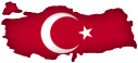 Officially known as Türkiye Cumhuriyeti or the Republic of Turkey, TÜRKIYE (Turkey) is a geographically diverse and predominantly Islamic country that straddles two continents. A small peninsula is in Europe, and the rest of the mainland is in Asia. Turkey borders seven countries: Bulgaria, Greece (both in Europe), Armenia, Iran, Iraq, Georgia, and Syria (the latter countries are in Asia). The capital is Ankara, which is the second largest city in Turkey. Istanbul, which developed alongside the Bosporus (also known as Istanbul Strait or İstanbul Boğazı), is the largest city and is often mistakenly thought of as Turkey's capital. Located close to the border with Azerbaijan, Mount Ararat (5137 meters, or 16,854 feet) is the highest peak. Turkey's currency is the Turkish Lira, and its ISO 4217 currency code is TRY.

 THAILAND is a well-known country located in Southeastern Asia on the Indochinese Peninsula. There are over 70 million residents. There are four bordering countries: Cambodia to the southeast, Laos to the east, Malaysia to the south, and Myanmar (Burma) to the west and northwest. The Gulf of Thailand is southeast, and the country's coast is studded with small offshore islands. Southwest of Thailand's southwest coast, the Strait of Malacca separates Thailand from the northern part of Indonesia's Sumatra island, which is located to the southwest. The capital of Thailand is Bangkok, known as Krung Thep in the Thai language. Other cities in Thailand include Chiang Mai, Chon Buri, Khon Kaen, Nakhon Ratchasima, Nakhon Si Thammarat, Phitsanulok, Phuket on the island of Phuket, Sara Buri, Songkhla, and Ubon Ratchathani. Thailand's currency is the Thai Baht, and its ISO 4217 currency code is THS.

● ● ● ● ● People and Places ● ● ● ● ● Tajik (Tajiki Persian) is the country's official language, while Russian is still used for communication by about 40,000 citizens as a remnant of the Soviet era. Other languages include Arabic, Ishkashimi (about 500 writers and speakers), Kyrgyz, Parya, Pashto (Southern), Persian (Iranian), Shughni, Uzbek, Wakhi, Yagnobi, and Yazgulyam. Over 80% of Tajik people are Muslims, 1.5% are Christians, and about 0.14% are Jewish. Tajikistan's capital is Dushanbe, which has over 750,000 residents living there. Other cities include Garm, Khujand, Khorugh, Murghob, Qurghonteppa, and Tursunzoda. The state's currency is the Tajikistani Somoni, and its ISO 4217 currency code is TJS.
● ● ● ● ● Land and Water Features ● ● ● ● ● Known in the Soviet era as Communism Peak (Pik Kommunizma), Pik Imeni Ismail Samani — also known as Ismoili Somoni Peak or Qullai Ismoili Somoni — is Tajikistan's tallest mountain. This peak stands 7,495 meters and 24,590 feet tall above sea level. Evgenii (Eugene) Abalakov was the first person (according to known records) to successfully climb this mountain in 1933. Mountains such as Qullai Ismoili Somoni, Pik Korjenevskaya or Korzhenevskaya Peak (7,105 meters), and Qullai Abuali ibni Sino* (7,134 meters) are located in the Pamir mountain range, dominating the land of eastern Tajikistan. Major lakes and reservoirs include Kayrakkumskoye Vodokhranilishche or Kairakum Reservoir in northern Tajikistan's panhandle region; Nurek Reservoir (southwest); Qarokŭl or Karakul (northeast); Sarezskoye or Sarez (east-central); and Yashikul (southeast). Visit this post from 2016 (↗) for information about rivers.
* Also known as Avicenna Peak or Pik Avicenna in Tajikistan, Qullai Abuali ibni Sino was renamed to commemorate Avicenna (Ibn Sīnā), a revered academic scholar of the Islamic Golden Age. During the Communist years of the Soviet Union (USSR) and into the early 2000s, this mountain was named Pik Lenin (Lenin Peak). This mountain is located on the Tajikistan-Kyrgyzstan border.
This post was updated with a new map and more information on January 30th, 2017.

 The Chinese island territory of TAIWAN (Republic of China) is located in Southeast Asia off the southeastern coast of mainland China and north of The Philippines. The true sovereignty of Taiwan is a debated issue. China maintains control over Taiwan, which constitutes the main island of Taiwan in addition to smaller island archipelagos. Over two dozen countries recognize Taiwan as a sovereign state. From northwest of Taiwan and then clockwise around the island, Taiwan Strait (Formosa Strait), East China Sea, Philippine Sea, Luzon Strait, and the South China Sea are water bodies surrounding Taiwan. The capital is Taipei (T'aipei), which has more than 2.7 million people in the city. Other cities and communities include Kaohsiung, New Taipei, Taichung, Tainan, and Banqiao (Panchiao). The currency is the New Taiwan Dollar, and its ISO 4217 currency code is TWD.

 SYRIA is a Mediterranean and Middle Eastern country located to the east of the Mediterranean Sea and the small country Lebanon. Jordan is to the south, Türkiye is to the north, and Iraq is east of Syria. The capital of Syria is Damascus (Dimashq). The currency is the Syrian Pound, and its ISO 4217 currency code is SYP.

 SRI LANKA is a raindrop-shaped island country in the Indian Ocean and in Southern Asia. India is 100 kilometers and 60 miles north and northwest of Sri Lanka, while the Maldives' northern section is approximately 745 kilometers and 460 miles west of Sri Lanka. The currency is the Sri Lankan Rupee, and its ISO 4217 currency code is LKR.
● ● ● ● ● People and Places ● ● ● ● ● According to Encyclopædia Britannica, Sri Lanka’s population in the year 2020 was about 22,010,000 and was ranked 59th among populations of the whole world’s countries, dependencies, and territories. The legislative capital of Sri Lanka is Sri Jayawardenepura Kotte, while the largest city and commercial capital is Colombo. Also simply known as Kotte, Sri Jayawardenepura Kotte is a suburb of Colombo
● ● ● ● ● Land and Water Features ● ● ● ● ● Did You Know? India and Sri Lanka once may have been connected to each other via a land bridge. In the late 1400s, it is believed that a tropical cyclone dumped enough water to partially destroy this land bridge and submerge most sections of it. Remnants still exist today in the form of limestone shoals, peeking above the water line on a submerged ridge. This chain of small islets is known as Rama Setu (Adam's Bridge) and connects Sri Lanka's Mannar island in the east with India's Pamban (Rameswaram) island in the west. The Gulf of Mannar, Palk Bay, and Palk Strait geographically separate Sri Lanka from India. The Bay of Bengal is east of Sri Lanka.


Singapore is also barely north of the Equator. Singapore is made up one main island and many small islands; you guessed right if you thought the main island is called Singapore! It is also called Pulau Ujong, pulau being the word for 'island' in the Malaysian language (an official language). As shown on the left map, smaller islands include Biola, Brani, Hantu, Lazarus, Pawai, Saint John's, Senang, Serangoon, Sudong, Tekong, and Ubin. Some small islands no longer exist because Singapore is home of a massive project reclaiming (building) more land between islands. For example, Jurong is an artificial island built on many former natural islands; those islands are shown in the second, smaller map. The Singapore Strait splits Indonesia away from Singapore, while the Johor Strait separates Singapore and Malaysia. Johar Baharu is a large Malaysian city that is north of the Johor Strait.
Post was updated with more info and a new map on July 28, 2013.
* The South China Sea is referred to with a different name in some countries, such as Indonesia, The Philippines, and Vietnam.

 The Arabian Peninsula's largest country at 2.15 million km² and 830,000 mi², the Kingdom of SAUDI ARABIA (Al-ʿArabīyah As-Saʿūdīyah, المملكة العربية السعودية) possesses majestic skyscrapers, wealthy royalty, deserts, oases, wadis (intermittent streams), and several remarkable mountain peaks and ranges. Saudi Arabia borders Iraq, Jordan, Kuwait, Oman, Qatar, United Arab Emirates, and Yemen and is west of Bahrain, a tiny island nation comprised of 33 islands. Saudi Arabia borders two bodies of water that are vital modes of exporting oil and other goods: the Red Sea (west) and the Persian Gulf (east). Saudi Arabia's currency is the Saudi Riyal, and its ISO 4217 currency code is SAR.
● ● ● ● ● People and Places ● ● ● ● ● Saudi Arabia's population is approaching near 30 million, according to a 2014 estimate. The capital and largest-populated city of Saudi Arabia is Riyadh, also spelled Ar Riyāḑ. Riyadh has over 5 million residents and various sites of interest including the Al Faisaliyah Center, Al Bujairi Square, Al Rajhi Grand Mosque, King Abdullah Park, Kingdom Centre Tower, Masmak Citadel, National Museum, and Wadi Hanifah.
Other major cities throughout Saudi Arabia include Abhā, Ad Dammam, Al Jawf, 'Ar'ar, At Ta'if, Buraydah, Ḥā'il, Jedda, Khamis Mushayt, Najrān, Sakakah, Sarurah, and Tabūk. Due to their pilgrimage sites and reverential religious history, Mecca and Medina are known as special holy cities according to Islamic tenets. Saudi Arabia's principal languages are Standard Arabic and Najdi Spoken Arabic. According to Ethnologue (↗), other major languages communicated throughout the kingdom include Bengali, Egyptian Spoken Arabic, English, North Levantine Spoken Arabic, Rohingya, Somali, Southern Balochi, Sudanese Spoken Arabic, Swahili, Tagalog, Turkish, Urdu, and Uyghur. Over 90% of Saudi Arabians are Muslims, followed by Christians (>5%), Hindus (>1%), Buddhists (0.33%), Sikhs (0.2%), and worshippers of ethnic religions (0.18%).
● ● ● ● ● Land and Water Features ● ● ● ● ● Standing at 3,133 meters (10,278 feet) in the Al Hijaz (Hejaz) mountain range, Jabal Sawda' is the highest point in Saudi Arabia, but not for all of the Arabian Peninsula — Jabal an Nabi Shu'ayb in Yemen takes that honor. The Rub' al Khali (Empty Quarter) is famous for being extremely arid and the largest interrupted sand desert on the globe, whereas deserts like the Sahara are somewhat divided up by mountain ranges and other features. Saudi Arabia is lacking when it comes to freshwater lakes, but there are plenty of wadis and oasis areas throughout the steamy-hot arid areas. Finally, the Sinai Peninsula of Egypt is separated by about 26 kilometers and 16 miles due to the Gulf of Aqaba. The Jabal Mazafah mountain range overlooks the water body from the Saudi Arabian side.
This post was comprehensively updated with more info on July 14th, 2017.

 RUSSIA, formerly the largest portion of the Soviet Union (USSR), is the largest country in the world spanning from northern Europe to eastern Asia. Russia shares borders with 14 countries: Azerbaijan, Belarus, China, Estonia, Finland, Georgia, Kazakhstan, Latvia, Lithuania, Mongolia, Norway, North Korea, Poland, and Ukraine. Russia also has an exclave called Kaliningrad, located in Europe southwest of Lithuania and north of Poland. The capital and largest city of Russia is Moscow (Moskva). The currency is the Russian Ruble, and its ISO 4217 currency code is RUB.
 QATAR is a relatively small, Middle Eastern country in western Asia with the highest GDP per capita in the world, according to 2013 data on the CIA World Factbook website. It is a peninsula projecting out into the Persian Gulf. The only bordering country is Saudi Arabia, which touches Qatar's southern border. The capital and largest-populated city of Qatar is Doha, spelled Ad Dawhah (cedilla under the first h) in Arabic. Even though the Hawar (Ḩawār) Islands are located very close to Qatar's west coast, they belong to Bahrain (↗), an island country located to the northwest. Speaking of islands, in satellite imagery you would notice on the eastern coast (above Doha) that there are several natural islands but also a developed, manmade island called The Pearl. A multi-lane bridge connects The Pearl and mainland Qatar. Ra's Rakan, an island also known as Jazīrat Ra's Rakan, is basically Qatar's small "hat" located at
  the top of the country. The currency is the Qatari Rial, and its ISO 4217 currency code is QAR.
Post updated with new map on December 3rd, 2013.
 The PHILIPPINES is an archipelago in Southeastern Asia, west of the Philippine Sea and east of the South China Sea. The country is northeast of Malaysia and west of Palau. The Spratly Islands are located nearby, not too far west of Palawan island. The countries Brunei, China, Malaysia, The Philippines, Taiwan, and Vietnam assert their claims of possession over this archipelago of islands. According to Encyclopædia Britannica, the Philippines’ population in the year 2020 was about 108,772,000 and was ranked 12th among populations of the whole world’s countries, dependencies, and territories. The capital, situated on the Philippines' largest island (Luzon), is Manila. Mindanao is the second largest island, and its largest city is Davao. The currency is the Philippine Peso (₱); the ISO 4217 currency code is PHP. Post updated with new map on 9/18/2013.
Another post to check out: Islands of the Philippines
 PAKISTAN, a predominantly Muslim country that is shaped like an east-facing bird, is located in Southern Asia and borders Afghanistan, China, India, and Iran. Many cities are located near the Indus River and its tributaries. From south to north, these cities include Kārachi, Hyderābād, Sukkur, Multān, Lahore, Rāwalpindi (south of Pakistan's capital), and Peshāwar. The cities that have populations greater than 1 million are Faisalābād, Gujrānwāla, Hyderābād, Karāchi, Lahore, and Rāwalpindi; Islamabad, experiencing rapid growth, is also part of this
  list but is surprisingly less populated than the aforementioned cities. The Indus River Delta of southern Pakistan floods frequently and is highly saline. The capital of Pakistan is Islamabad (Islāmābād with the accents) and the largest city is Karāchi, which borders the Arabian Sea west of the Indus River. A region in the beak shape of Pakistan, Kashmir and the surrounding area are both claimed by India as indicated by the map's dotted line. Pakistan's currency is the Pakistani Rupee, and its ISO 4217 currency code is PKR.
 OMAN is a Middle Eastern country bordering the Arabian Sea in the east and the Gulf of Oman in the north. It is east of the countries Saudi Arabia, United Arab Emirates (U.A.E.), and Yemen. The capital of Oman, located along the northern coast and north of the Al Hajar mountain range, is Muscat (also spelled Masqat). According to Encyclopædia Britannica, Oman’s population in the year 2020 is about 4,593,000 and is ranked 126th among populations of the whole world’s countries, dependencies, and territories. The currency is the Omani Rial, and its ISO 4217 currency code is OMR. Only a handful of countries have exclaves or a single exclave, and Oman has one in its northern extent on a peninsula. Exclaves are areas of land belonging to a particular country, but are separated from that country because of another. Sticking vertically into the Strait of Hormuz, the Musandam Peninsula of northern Oman serves as a boundary where the Persian Gulf - northwest of Oman and north of the U.A.E. - and Gulf of Oman meet. This is unusual: there is an exclave within an exclave, located between the Musandam Peninsula to the north and mainland Oman to the south. The Oman-occupied exclave is shaped like a doughnut, and here's why! A small area of U.A.E. land is surrounded by Oman territory, and that is then surrounded by the U.A.E.


 NEPAL (नेपाल) is a mountainous country located in the Himalayan Mountains in Southern Asia, between China to the north and India to the south. Nepal straddles the Himalayas mountain range and is known for boasting the world's largest mountain. There are multiple large glaciers in northern Nepal among the country's countless mountains. South of the Himalayan range lies the west-east parallel Mahabharat Range. Located in northeastern Nepal, Mt. Everest (Sagaramāthā, सगरमाथा) towers into the sky on the border with China. Featured below, Nepal's flag is the only country flag in the world not shaped like a rectangle or square. The capital of Nepal, in the eastern part of the country and west of Mt. Everest, is Kathmandu. Other Nepalese cities include Bhaktapur, Biratnagar, Nepalganj, Patna, and Udaypur. With ₨ and रू as its symbols, the Nepalese Rupee is the national currency. The Nepalese Rupee's ISO 4217 currency code is NPR.
Blog Content
● The author of this GeoFact of the Day Blog creates and curates original, authentic content and posts information based on established facts. Blog posts are not generated by artificial intelligence (AI) but published by the author.
● Content and image graphics from other sources are properly credited. Many geography facts are well-established and therefore do not belong to any one source, but occasionally a fact requires attribution/credit if it is unique and hard-to-find — for example, facts found from specific cultural, anthropological, geological, and scientific (etc.) research.
● I do not copy and paste from other websites. Therefore, all posts are original but may sometimes include information, links, and/or images from credited external sources. To use a GeoFact of the Day Blog image for your website or project, write a comment below a post — then I may approve your request.
● Feel free to offer comments, suggestions, and compliments on any post or page! You can be anonymous. Spam comments with non-relevant links will be deleted.
● Thanks for your loyal readership on the educational and reliable GeoFact of the Day Blog, in existence since 2008!


