Search for Posts, Maps, and Topics

1) True or false: according to 2018 data from UNESCO's Institute for Statistics, LESOTHO's youth literacy rate is 95.2%.
There is a town named Bratsberg near the center of ____________________.
A — NORWAY
B — GERMANY
C — LATVIA
3) Which of the following is not a city in Lebanon?
A — Beirut
B — Tyre
C — Riyadh
D — Tripoli
4) Being home to an interesting red-and-white 1800s lighthouse (↗) and having a namesake current, Cape Agulhas is located southeast of Cape Town, SOUTH AFRICA. The southernmost point of Africa, this cape is known as a separation point between the Atlantic Ocean and __________ Ocean.
ANSWERS
Question 1:
True
Question 2:
A . . . . . Norway
Question 3:
C . . . . . Riyadh which is in Saudi Arabia (↗); Tripoli (D) is a city in Lebanon and also in Libya (↗)
Question 4:
Indian
Happy New Year! January 2023’s continental quiz is a continuation of the Africa GeoQuiz in December of last year. After testing your African trivia prowess, you can further test your geographic knowledge (↗) with other geography quizzes from GeoFact of the Day. The answers are listed below; enjoy and good luck!
1) Fill in the blank: _________ from desert land in present-day MALI was once so highly prized that an ounce of this resource carried the same value as an ounce of gold!
A — sand
B — salt
C — pepper
2) True or false: the Olduvai Gorge, Serengeti grassland region, and Mount Kilimanjaro are all notable landscape features of northern UGANDA.
3) The naming (etymology) of BURKINA FASO translates in English to “land of the honest men” as well as “land of the _________.”
A — liars
B — incorruptible
C — brazen
4) Fill in the blank: tucked in the northeast corner of EQUATORIAL GUINEA, Ebebiyín is a “corner city” of about 36,000 residents near _________ as well as GABON.
A — CAMEROON
B — DJIBOUTI
C — LESOTHO
D — MADAGASCAR
5) MAURITIUS is one of the first countries around the globe to convert a relatively unconventional material to generate electricity. Steam turbines powered by this crop produce up to one fifth (1/5) of the island’s electricity during the annual harvest season! Which crop is especially used in Mauritius for energy needs?
A — broccoli
B — sugarcane
C — plantains
D — guava, mangoes, and papaya
6) True or false: Lake Togo gave the country of TOGO its name. Togo is derived from the Ewe word togodo, meaning “behind the lake.”
7) One provincial name in SOUTH AFRICA translates from the Sotho language into English as the “place of gold.” Which is the correct province?
A — Gauteng
B — Kwazulu-Natal
C — Western Cape
ANSWERS
Question 1:
B . . . . . salt
Question 2:
False . . . . . northern Tanzania
Question 3:
B . . . . . incorruptible
Question 4:
A . . . . . Cameroon
Question 5:
B . . . . . sugarcane
Question 6:
True
Question 7:
A . . . . . Gauteng
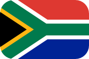
The Republic of SOUTH AFRICA and its citizens celebrated its 26th annual Freedom Day on April 27th. The first Freedom Day was established in 1994 to commemorate South Africa's first post-Apartheid election, which signified a moment of national reconciliation and unity. Last December 11th, South Africans commemorated Independence Day. The independence of South Africa from the United Kingdom (Great Britain) came about on December 11th, 1931 — foreshadowed in terms of the Balfour Declaration of 1926.
● Apartheid, unfortunately
● Cape Town and Table Mountain
● Deafening vuvuzela horns
● Giant steaks
● Nelson Mandela
● Peace and reconciliation
● Relative prosperity compared to other African countries
● Springboks
● Surfing
● Wildlife safaris
Most items were listed in The Africa Book; the MLA citation is below. What are other "trademarks" of this African country? Feel free to share your thoughts with a comment!
Phillips et al. The Africa Book: A Journey through Every
Country in the Continent. Lonely Planet, 2007.
— #AfricaWeek —
According to National Geographic MapMaker (mapmaker.nationalgeographic.org) and MIT's Observatory of Economic Complexity (OEC), the following items are major exports of SOUTH AFRICA: animal food, antimony, apples, automobiles, beverages (especially juice and wine), centrifuges, cereal, chromium, citrus fruit, clothing and textiles, coal, copper, corn (maize), dairy products, diamonds, equipment and machinery, fertilizer, furniture, gemstones, gold, grapes, iron, jewelry, manganese, meat, natural gas, nickel, nuts, packaged food, pears, phosphates, pitted fruit (e.g. nectarines and peaches), platinum, rare earth elements, rolled tobacco, salt, steel, sugarcane, tin, vanadium, wheat, and wood pulp. According to the International Monetary Fund (data.imf.org), countries and territories buying and importing most of those exports (February 2017 statistics) include China (top importer), Germany, the United States, Japan, India, Mozambique, Namibia, Botswana, the United Kingdom, Belgium, South Korea, the Netherlands, Zambia, Zimbabwe, the United Arab Emirates, Hong Kong, Spain, Lesotho, Swaziland, Italy, Kenya, Taiwan, Australia, Angola, and France.
Located south of the Limpopo River and the Botswana-Zimbabwe-South Africa border, Mapungubwe Cultural Landscape in SOUTH AFRICA's Limpopo Province was the location of an ancient civilization, the Kingdom of Mapungubwe. This kingdom existed in the late 1000s through the early 1200s. Archaeologists rediscovered Mapungubwe, its burial sites, and even multiple skeletons in the early 1900s, and in 2003 UNESCO designated it as a World Heritage Site for its cultural significance. The area also has breathtaking landscapes, as seen by the photo below, and cave paintings. UNESCO's website states that Mapungubwe was "the largest kingdom in the African subcontinent" during its climax of power. To preserve the Mapungubwe Cultural Landscape, there are restrictions and stipulations on visitor and tourist access.

This beautiful image of the Mapungubwe landscape, "Mapungubwe Hill Panorama," is copyrighted (©) by Martin Heigen on Flickr and has this Creative Commons license, which is non-commercial. Click to enlarge image in a lightbox window.
The places that are bolded and underlined in this post are not administrative regions of SOUTH AFRICA, but they are regions indicating their cultural significance and the primary ethnic group living in each area. The "lands" in the western part of South Africa, located near the Atlantic Ocean coast, include Bushmanland, Little Namaland, and Namaqualand. Pondoland is along the southeast coast with towns like Lusikisiki, Mpahlane, Nqutyana, and Port Saint Johns; a marine protected area (MPA) off the coast is named Pondoland. Stellaland is in the North-West administrative province of Northern South Africa, while Zululand is along the Indian Ocean coast in the KwaZulu-Natal province of Eastern South Africa. Lesotho (completely inside South Africa) and Swaziland (almost inside South Africa) are countries that are similar to the South African regions because they are named after peoples: the Basotho (singular: Sotho) and Swazis.
Peninsula Week Post #1
Being notorious as a dangerous peninsula for sailors and explorers to sail near, the Cape of Good Hope is a peninsula (land surrounded by water on three sides) in SOUTH AFRICA. It juts out into the Atlantic Ocean and is at the tip of the more generalized Cape Peninsula. The name of this peninsula is self-evident that seafarers need hope and luck to battle with oftentimes choppy waves and other obstacles! Valsbaai (False Bay) is to the right of Cape of Good Hope and left of Kaap Hangklip, another peninsula. South Africa's legislative capital, Cape Town, and communities like Grassy Park, Simonstown, and Vishoek are north of Cape of Good Hope.
Out of all the countries in Southern Africa, the Kingdom of LESOTHO, MALAWI, and NAMIBIA have the highest percentage of Christians. Anywhere from 80 to 90% of the people in these countries are Christians, while many of the rest believe in indigenous beliefs. There is a small population of believers in other religions. Other Southern African countries with high percentages of Christians include ANGOLA, SOUTH AFRICA, SWAZILAND, and ZAMBIA. Christian missionaries from around the world played a pivotal role in introducing Christianity to Sub-Saharan Africa.
EASTERN CAPE, a province of SOUTH AFRICA located south and southwest of LESOTHO, formerly had one exclave completely surrounded by land belonging to KWAZULU-NATAL. Eastern Cape's exclave (which is Kwazulu-Natal's enclave) was eliminated by a change in the two provinces' boundaries. As seen on maps from the middle 2000s and before, that enclave/exclave existed east of southern Lesotho and included the following towns: Umzimkulu, Sneezewood, Bisi, Bontrand, and Riverside. Interesting to note, most roads in this area currently are unpaved, possibly signifying a lack of infrastructure development and low population. Regional Route R56 and other routes are paved. After the boundary fix, the aforementioned towns are now in Kwazulu-Natal province. You can still see the former boundary in Bing Maps (east-southeast of Lesotho), but only in the initial worldwide view.
 In Southern Africa, the Drakensberg Mountains is a remarkable chain of tall peaks and gorgeous landscapes that runs along LESOTHO's southeastern border with SOUTH AFRICA.
The tallest peak of the Drakensberg Mountains, Thabana Ntlenyana, stands 11,424 feet (3482 meters) tall in eastern Lesotho. A peak with a French name, Mont-Aux-Sources also stands in Lesotho at 10,823 feet (about 3299 meters). Mafadi, standing around 11,318 feet (3450 meters) tall on the border between Lesotho and South Africa, is South Africa's highest peak. Cleft Peak also lies on the border with a peak of 10,760 feet (3280 meters). Giant's Castle (10,824 feet and 3314 meters) and Njesuthi (around 11,188 feet/3410 meters) lies predominantly in South Africa.

Map Credit: © Maps of the World (mapsofworld.com).
Refresh the page if map doesn't appear right away.
Compared to other African countries, SOUTH AFRICA has a more financially prosperous economy. The Netherlands and British Empire colonized South Africa, and the country achieved independence in 1961. There are 6 bordering countries: Botswana, Lesotho, Mozambique, Namibia, Swaziland, and Zimbabwe. South Africa also borders the Indian Ocean and the South Atlantic Ocean. There are 3 capitals, each for different purposes. Bloemfontein is the judicial capital, Cape Town is the legislative capital, and Pretoria is the executive capital. The currency is the South African Rand, and its ISO 4217 currency code is ZAR.
Blog Content
● The author of this GeoFact of the Day Blog creates and curates original, authentic content and posts information based on established facts. Blog posts are not generated by artificial intelligence (AI) but published by the author.
● Content and image graphics from other sources are properly credited. Many geography facts are well-established and therefore do not belong to any one source, but occasionally a fact requires attribution/credit if it is unique and hard-to-find — for example, facts found from specific cultural, anthropological, geological, and scientific (etc.) research.
● I do not copy and paste from other websites. Therefore, all posts are original but may sometimes include information, links, and/or images from credited external sources. To use a GeoFact of the Day Blog image for your website or project, write a comment below a post — then I may approve your request.
● Feel free to offer comments, suggestions, and compliments on any post or page! You can be anonymous. Spam comments with non-relevant links will be deleted.
● Thanks for your loyal readership on the educational and reliable GeoFact of the Day Blog, in existence since 2008!