Search for Posts, Maps, and Topics

First of all, I want to express my thoughts and well wishes for everyone in JAMAICA 🇯🇲, HAITI 🇭🇹, CUBA 🇨🇺, and other places in the Caribbean dealing with Hurricane Melissa and its destructive aftermath.
In the sixth episode of The Amazing Race Season 38 (U.S. Edition), teams drove a manual stick-shift vehicle northwest from Dubrovnik, CROATIA 🇭🇷 (HRVATSKA) to the town of Trsteno. Here, they visited the Trsteno Arboretum featuring trees that are over 500 years old. 🌳 Teams found a clue near the arboretum’s Neptune statue then drove further northwest along the Adriatic Sea coastline to the partially walled town of Ston. They encountered the “Bag It Up” versus “Pull It Up” Detour challenge. In “Bag It Up”, teams filled ten bags of local raw salt — each bag weighing slightly over 20 pounds each. In “Pull It Up”, teams visited a major oyster harvesting area known as Mali Ston Bay. They rowed a boat to find buoys with oysters attached; the teams then gave those oysters to a local restaurant known as Bota Sare. 🦪

Overview map of Trsteno — a town northwest of Dubrovnik and known for its arboretum
Remaining in the town of Ston, teams visited Park Komarda for the “Who Knows Their Way Around Croatia?” Roadblock. 🚧 With the navigational help of a 3D relief map of Ston, a member of each team visited several locations throughout the town to find and remember Croatian (Hrvatskan) facts. These facts involve multiple topics: letters not featured in the Croatian alphabet (Q, W, X, and Y), one of the several mottoes of Croatia (“As long as there is heart, there is Croatia”), highest mountain in Croatia at 6,007 feet* (Dinara), famous poet in Croatia (Ivan Gundulić), original length of the Walls of Ston (22,965 feet*), the date when Parliament proclaimed independence from Yugoslavia (June 25th, 1991), first king of Croatia (King Tomislav) 👑, and Croatia’s coastline length (3,625 miles*). Amazing Race contestants arrived back at the map and were tested with three questions asked by a Croatian. Contestants who did not answer the questions correctly had to answer a different set of questions for their next attempt, so some of them went back to the locations to memorize all facts.

Overview map of Ston — the second town featured in this episode
Prapratno Cove was the Pit Stop for this episode. 🏁 Eric and Tucker arrived in first place and both won another trip — this time to various locations in EGYPT 🇪🇬 including Cairo, Alexandria, and the famous pyramids. Tucker excitedly mentioned that Egypt was always on his bucket list, so it is awesome that he can check that one off! ☑ Kristine and Rubina were the eighth and last team to arrive, so they were eliminated from The Amazing Race.
* 6,007 feet equals 1,831 meters, 22,965 feet equals 7,000 meters, and 3,625 miles equals 5,834 kilometers.
People all across JAMAICA are celebrating their country's Independence Day today. Jamaica achieved independence from the United Kingdom in 1962. Happy Independence Day!
 Click on the map image above to enlarge it in a pop-up lightbox window.
With about 200 kilometers of seawater separating it from Cuba and Haiti, JAMAICA is an emerald-green island country in the northwest Caribbean Sea. Regarding administrative divisions of its land, Jamaica is comprised of fourteen (14) parishes: Clarendon, Hanover, Kingston, Manchester, Portland, Saint Andrew, Saint Ann, Saint Catherine, Saint Elizabeth, Saint James, Saint Mary, Saint Thomas, Trelawny, and Westmoreland. Below are the parishes' first-order administrative capital cities:
Clarendon — May Pen
Hanover — Lucea
Kingston — Kingston (national capital)
Manchester — Mandeville
Portland — Port Antonio
Saint Andrew — Half-Way-Tree
Saint Ann — Saint Ann's Bay
Saint Catherine — Spanish Town
Saint Elizabeth — Black River
Saint James — Montego Bay
Saint Mary — Port Maria
Saint Thomas — Morant Bay
Trelawny — Falmouth
Westmoreland — Savanna-la-Mar
According to National Geographic MapMaker (mapmaker.nationalgeographic.org), the following items are major exports of JAMAICA: ackee fruit, alumina, bananas, bauxite, cement, citrus fruit, clothing, coffee, gypsum, lightly manufactured goods, limestone, petroleum, rum and other beverages, seafood (especially crabs and shrimp), sugar, telecommunications equipment, and yams. According to the International Monetary Fund (data.imf.org), countries and territories buying and importing most of those exports (February 2017 statistics) include the United States (top importer), China, the Netherlands, Russia, Canada, the United Kingdom, the United Arab Emirates, Trinidad and Tobago, Venezuela, Suriname, France, Guyana, Barbados, Saint Lucia, Tajikistan, Antigua and Barbuda, Belize, Saint Kitts and Nevis, Chile, and Colombia.
The IUCN Red List of Threatened Species™ for JAMAICA in North America lists 60 critically endangered species and 77 endangered species. Jamaica's critically endangered species include the Arntully Robber Frog, Blue Mountain Yacca tree, Elkhorn Coral, Hawksbill Turtle, Jamaican Flower Bat, Jamaican Iguana, and Staghorn Coral. Endangered species include the Boulder Star Coral, Homerus Swallowtail butterfly, Jamaican Rumpspot Frog, Jamaican Snoring Frog, and Scalloped Hammerhead shark.
Two Interesting Endangered Species
Multiple endangered species around the world are noted for their special sizes, colors, actions, and other characteristics. As you might have guessed, there is a reason why the Jamaican Snoring Frog is named as such. The male frog does emit a loud snoring sound from time to time. Averaging about 4.7 inches, this species is also one of the world's largest tree frog species. The Homerus Swallowtail is the Western Hemisphere's largest butterfly with a wingspan approximately 6 inches. Stamps from Chad, Dominica, Ghana, and Jamaica feature the iconic black-and-yellow flyer.
According to the IUCN Red List of Threatened Species™ for JAMAICA in North America, there are officially six extinct species and possibly more. These species are extinct in Jamaica: the Caribbean Monk Seal, Jamaica Giant Galliwasp lizard, Jamaican Monkey, Jamaican Rice Rat, Myrcia skeldingii plant, and Psidium dumetorum plant.
Surrounded to the south by the Caribbean Sea, Portland Point is the southernmost feature of JAMAICA island. While Portland Point is the southern point of the island of Jamaica, the Pedro Cays about 150 kilometers south of Jamaica are the country's southernmost extent since the Pedro Cays are a Jamaican territory. Portland Point is the southern point of a larger unnamed peninsula. A lighthouse and towns such as Mahoe Gardens, Portland Cave, Portland Cottage, and Rocky Point are on the peninsula. To the east of Portland Point and the peninsula is Portland Bight, a water body designated by the Jamaican government as part of the Portland Bight Protected Area, created to preserve and protect marine but also land-based species.
The Greater Antilles is an island group containing the largest islands in the Caribbean Sea. The major islands that are part of this group are the Cayman Islands, CUBA, JAMAICA, Hispaniola (DOMINICAN REPUBLIC and HAITI), and Puerto Rico.
I saw a wonderful National Geographic photo of the Dunn's River Falls, which are located in Northern JAMAICA. In the top left of this photo, which is taken by Hiroyuki Matsumoto, a couple of daring adventurists attempt to climb the spectacular falls. Take a look by clicking on this link (opens in a new window/tab).
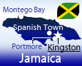 JAMAICA is a relatively well-known island country with English being the official language. Jamaica is south of Cuba and west of Haiti. The capital is Kingston, which is the largest city with almost 600,000 residents. The second most-populated city is Spanish Town, with a population greater than 145,000. The currency is the Jamaican Dollar, and its ISO 4217 currency code is JMD.
Blog Content
● The author of this GeoFact of the Day Blog creates and curates original, authentic content and posts information based on established facts. Blog posts are not generated by artificial intelligence (AI) but published by the author.
● Content and image graphics from other sources are properly credited. Many geography facts are well-established and therefore do not belong to any one source, but occasionally a fact requires attribution/credit if it is unique and hard-to-find — for example, facts found from specific cultural, anthropological, geological, and scientific (etc.) research.
● I do not copy and paste from other websites. Therefore, all posts are original but may sometimes include information, links, and/or images from credited external sources. To use a GeoFact of the Day Blog image for your website or project, write a comment below a post — then I may approve your request.
● Feel free to offer comments, suggestions, and compliments on any post or page! You can be anonymous. Spam comments with non-relevant links will be deleted.
● Thanks for your loyal readership on the educational and reliable GeoFact of the Day Blog, in existence since 2008!


